2025 Hurricane Season: NOAA Forecasts Above-Normal Activity
Warmer Waters Fueling Storms
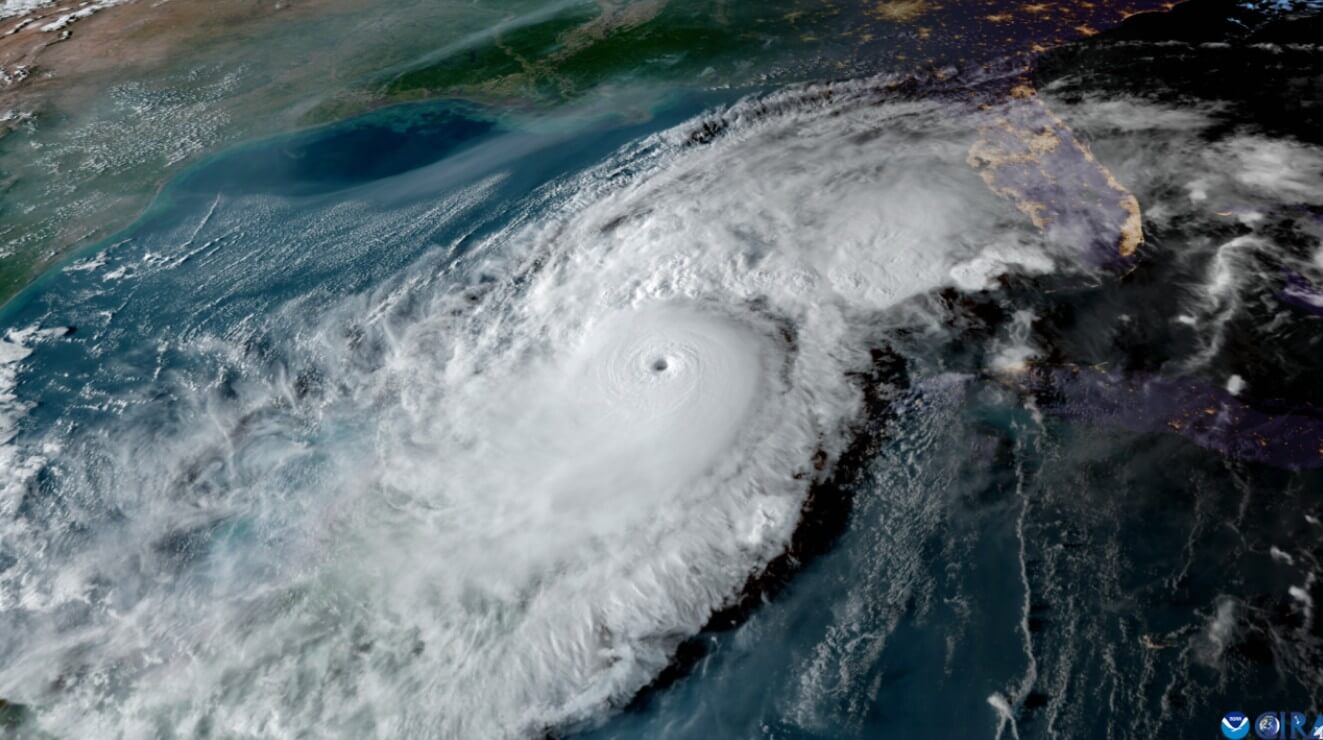
Above-average Atlantic Ocean temperatures are setting the stage for increased hurricane activity. These warmer waters provide more energy, essentially acting as fuel to supercharge developing storms.
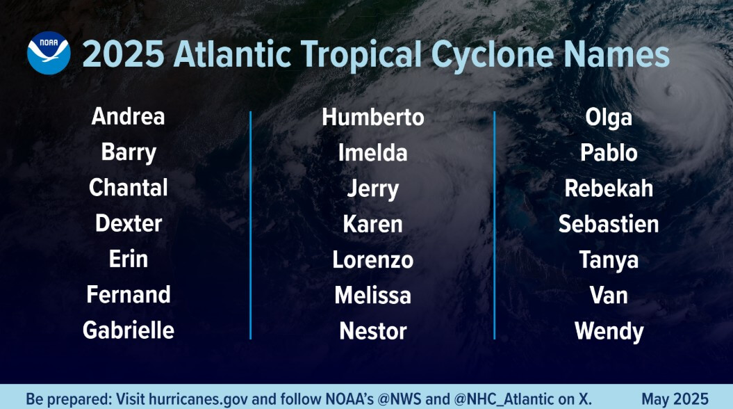
The 2025 Atlantic hurricane season, running from June 1 to November 30, has a 60% chance of being above-normal, according to NOAA.
Factors Driving the 2025 Hurricane Season Forecast
Several key elements are contributing to NOAA's prediction of an above-normal 2025 Atlantic hurricane season.
The Atlantic Basin continues its high-activity era, characterized by significant ocean heat content and reduced trade winds.
Enhanced Hurricane Preparedness & Forecasting for 2025
"In my 30 years at the National Weather Service, we've never had more advanced models and warning systems in place to monitor the weather," states NOAA's National Weather Service Director Ken Graham.
For the 2025 hurricane season, NOAA is rolling out improved hurricane analysis and forecasts.
NOAA's National Hurricane Center (NHC) and the Central Pacific Hurricane Center will now issue tropical cyclone advisory products up to 72 hours before storm surge or tropical-storm-force winds impact land.
Enhanced communication products for this season
- Spanish language text products for the Tropical Weather Outlook, Public Advisories, the Tropical Cyclone Discussion, the Tropical Cyclone Update and Key Messages.
- An experimental version of the forecast cone graphic
- Depiction of inland tropical storm and hurricane watches and warnings in effect for the continental U.S.
- New - Graphic will highlight areas where hurricane watches and tropical storm warnings are in effect, simultaneously.
- Rip current risk map when at least one active tropical system is present.
New tools for this year
- NOAA National Environmental Satellite, Data, and Information Services (NESDIS), Office of Marine and Aviation Operations & NOAA Research,
- New, experimental scanning radar system called ROARS on NOAA’s P-3 hurricane hunter research aircraft.
- Will scan under the plane to collect data on waves and wind structure.
- Probabilistic Precipitation Portal
- User-friendly access to see the forecast for rain and flash flooding up to three days in advance.