Arctic by RIB - Episode 12 A Long Day North
DAY 31st/32nd - Tuesday/Wednesday 2-3 of August 2022
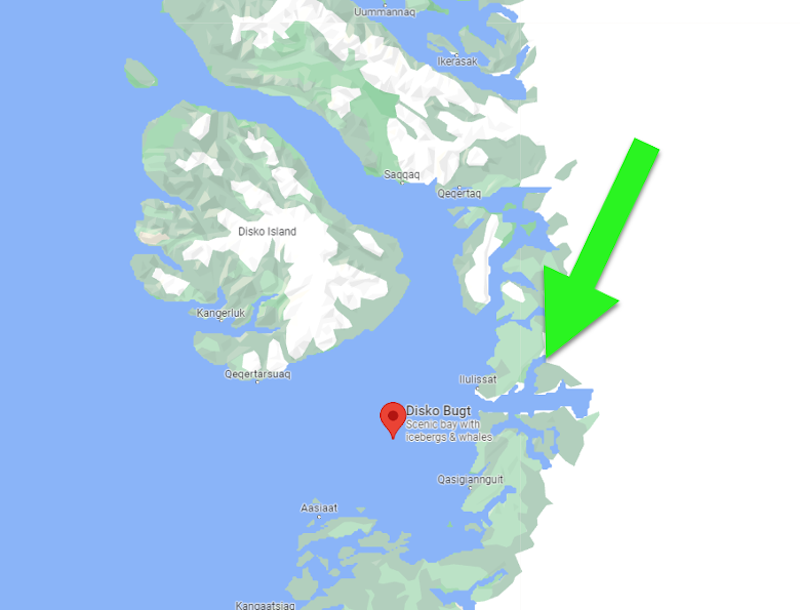
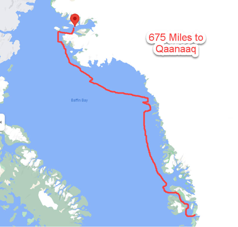
From Ilulissat to Qaanaaq
On Tuesday at 11:00 in the morning we left behind the port of Ilulissat and turned our bow towards the strait of Disco Island, hurrying toward our next destination due to the fact that Wednesday the weather was forecasted to get worse.
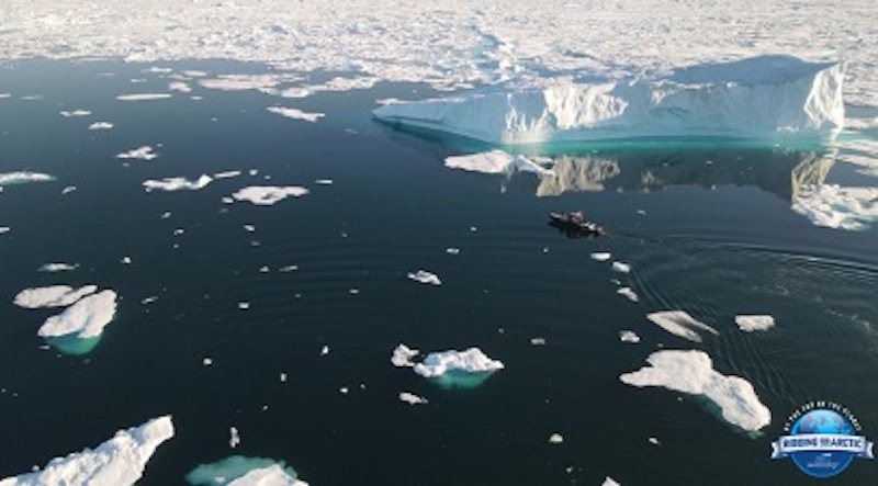
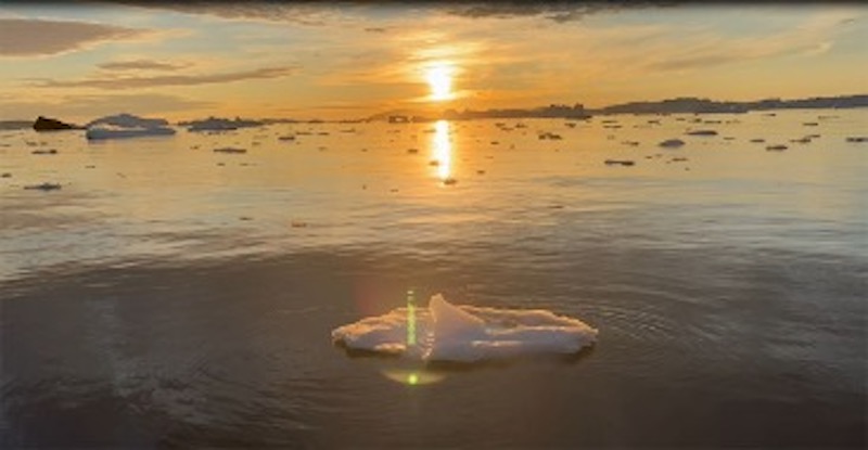
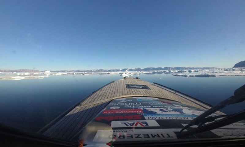
The entire bay of Ilulissat was filled with icebergs while, as usual, the fog was very thick. We were therefore forced to travel at a very low speed and navigate totally by our GPS for fully 30 miles until approaching the entrance to the narrow channel formed between Disco Island and the west coast of Greenland.
This channel has a northwestern direction with a length of approximately 72 nautical miles and a width varying between 6-12 miles (9.6-19.3 km). Fortunately, entering the channel, the visibility got much better so that we could see the large icebergs from a distance of about 100 meters.
We increased our speed and were now traveling at over 30 knots.
Time 15:00΄ / Day Tuesday
Position: 70°45΄N 54°50΄W
After 4 hours we were out of the channel, traveling 126 nautical miles with a fuel consumption of 444 liters (117.3 gal). The sea throughout this distance was calm and the air temperature +6 °C.
Facts About Greenland
Greenland is a mountainous country and the largest island of the world with a total area of 2,166,086 km2. The country is geographically located on the North American continent. 81% of Greenland is covered by ice, and the total population is just about 57,000.
Comprised entirely of vast tundra, Greenland has the world´s lowest population density. Counting the ice-free areas only, it is a mere 0.3 persons per square kilometer.
In terms of geopolitics, however, it is a part of Europe and is a self-governing region within the Kingdom of Denmark. In 1721, Greenland became a Danish colony, in 1953 a Danish County, and in 1979, home rule was granted.
Self-government was established on June 21 2009. Along with Denmark, Greenland was an EU member from 1973 on. Following a referendum in 1982, Greenland left the union in 1985 and has not been a member since.
All towns and settlements are located along the coastline. No roads exist between towns, and all travel is by ship and aircraft only. Most of the population lives on the southern west coast. This includes the capital Nuuk with around 19,000 inhabitants. Greenland has its own national flag, and issues its own stamps, but does not have a national currency. Danish Krone (DKK) is legal tend
Time 20:00΄ / Day Tuesday
Position: 72°47΄N 56°09΄W – Upernavik
The sea continued to be open, with minimal ice, and so in the next 5 hours we covered another 130 nautical miles. At 20:00 we entered the port of Upernavik.
Upernavik is located on the western side of a small island which bears the same name and is the most important settlement for us in northwest Greenland. It has a population of approximately 1,100 -- and fuel!
On the port side is the fuel station where we filled the main tanks of the boat as well as the large flexible one with 450 liters (119 gal) of gasoline for our twin Suzuki 350-hp outboards. According to plan we would spend the night there, but we all wanted to continue our course.
So, at 21:30 we turned our bow towards the North. After all, “darkness” is an unknown word at this time in these latitudes.
Time 00:15 / Day Wednesday
Slow Going Due to Ice
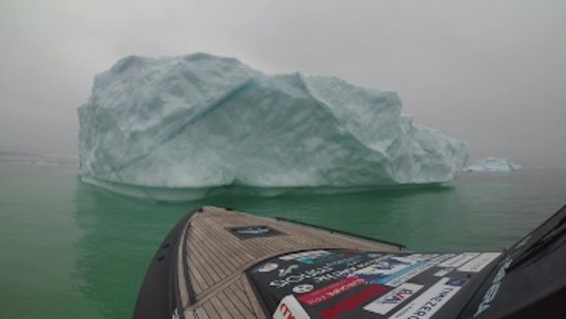
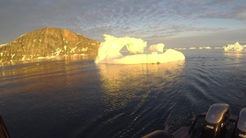
The sun was still high on the horizon even though it was almost midnight. We were several miles north of Upernavik. Our course was strewn with many icebergs and still more small pieces of ice, which we had to break to make our way through. The shivering sound of the small ice hitting our hull was an unforgettable sound.
We were determined to continue our course to our ultimate destination, but the situation was challenging. After more than 12 hours of tough navigation, we were already exhausted and had a long way to go.
One of us rested in the cabin for an hour while the other two continued scanning the horizon and looking for channels between the ice. We changed shifts at the wheel every hour in order to keep ourselves alert.
Time 01:30΄ / Day Wednesday
Position: 74°31΄N 57°30΄W
Town Locked in Ice
We were just 7 miles (11.2 km) outside the small settlement of Kullorsuaq and Devil's Thumb. But we were surrounded by ice. We were only going at 5 knots and maneuvering between the countless ice floes while trying to approach the village. We arrived within 5 miles of the small port of Kullorsuaq but the sea in front of us seemed inaccessible due to the ice.
More importantly, there was a serious danger of being trapped within the ice field. After another hour we gave up on our effort. We turned back to the open sea—we’d have to travel a lot further to find fuel and refuge.
Time 07:30΄ / Day Wednesday
Position: 75°22΄N 63°30΄W
We were all exhausted from the long day and from constantly battling the ice. Even staying awake at the wheel became a challenge.
But we had to push ourselves to get to some port of refuge to refuel and rest.
During the last few hours we maintained high cruising speeds of up to 35 knots. But calculating the fuel we had in our tanks, it began to seem that we might run short. And there was always the possibility of encountering ice again and having to deviate from our course.
We decided to slow to stretch the fuel remaining. We eased along at 7 knots for the next two hours to gain some range.
It worked—a recalculation showed we now had enough to cover the remaining 40 NM to Qaanaaq on plane.
Another Challenge—An Ice Dam Blocks the Way
But you can never be sure of anything in these latitudes. The conditions change so rapidly that you can experience all seasons within a few hours.
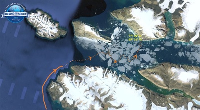
It had not been one hour since the anxiety of fuel had left us when 20 miles before Qaanaaq we found ourselves at a dead end.
An endless ice dam stretched in all directions ahead of us. Everywhere we looked there was only ice. An all-white desert, while the brown mountains and their snow-capped peaks could be seen far out of reach in the background.
It was as if suddenly the whole ocean had frozen in front of us.
We were still 20 miles outside the settlement. We had traveled 675 miles to get here, over some 28 hours of continuous running at cruising speeds of 5 to 35 knots.
We didn't sleep more than two hours each. Many times we felt exhausted, our head was heavy and drooping and often our eyes closed when we did not plan on it—very dangerous for the man at the wheel. But we had no choice but to go on, to reach the village where we could get fuel and rest.
It was 15:00΄ of Wednesday.
Position: 77°19΄N 70°16΄W
The calm sea and the bright sun were our allies. We were trying to stay calm but anxiety and fear were creeping in. We concentrated to keep our minds clear and our eyes constantly searching for channels through the ice. We continually snaked to port or starboard to thread our way through the blockages that sometimes seemed impassable.
All of our routes eventually led not to safety but to yet another ice dam.
After another hour of searching, we realized we could not find a path without help from above.
A Drone Saves the Day
Fortunately, we had just that help aboard—a drone with camera that could give us a bird’s eye view.
Our last option was to use the drone—something we perhaps should have thought of sooner. We raised it high and launched it. We sent it left and right sweeping almost the full width of the channel. After a few minutes the camera’s eye discerned a small passage between two large icebergs, to our south-east, which led into a wider channel that appeared to be navigable. Perhaps a way to Qaanaaq!
With the drone back aboard, we headed for what we hoped was a way to safety.
Finally, with two tall icebergs on our right as a reference point, we managed to find our way into the wider channel. The boat continued to push small chunks of ice aside as we eased along, but at last we were making progress.
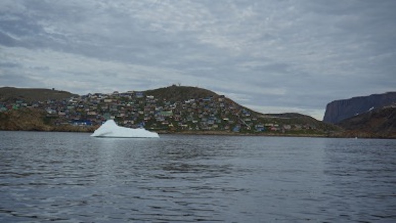
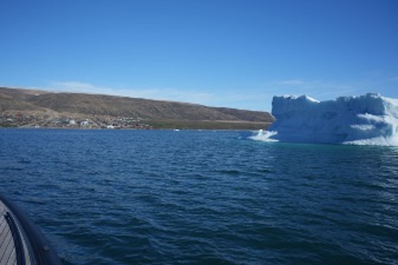
Eventually, the village came into view—what a relief! The colorful houses of Qaanaaq were a more than welcome sight, as was the ice-free mountainside above it.
Episode 13 -- Beyond Qaanaaq -- in the next edition of BoatTEST’s “On the Water” Newsletter