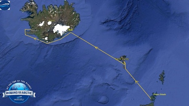
Arctic by RIB-Episode 4 Faroe Island to Iceland
Day 7 / Saturday 9 July 2022
Position: 62°00΄N 06°46΄W – Torshavn Faroe Islands
At 06:00 in the morning the alarm clocks rang brutally but no one moved from the berth. It was obvious that we needed more rest but there was no time available. At 06:30 we untied our bow lines and slowly left the marina.
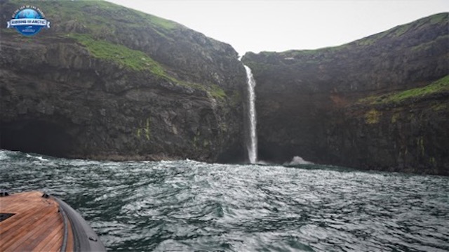
Before setting sail for Iceland, we navigated along the western shores of Vagar Island to visit the Mulafossur waterfall which is one of the most attractive sights of the Faroe Islands. Of course, we found it very difficult to approach as the very big waves at their confluence with the tide made the ocean boil.
The sea once again was just short of terrifying.
We were slowly going along at 8-12 knots trying to constantly avoid the huge jets that formed at each crest of the waves.
We made enough time to approach the islet of Mycenae and from there we turned our bow west towards the fjord where the waterfall is located. Despite the large, disturbed swell, we managed to stand off a short distance from where its waters burst into the sea. We marveled at the sight of the rushing waters of the waterfall as they fell with force from the high vertical rocks into the Atlantic.
But we had little time to enjoy the view. We had to move on because we had a long way to go. We set a course for Hofn, Iceland, some 431 miles (693 KM) away.
Time 11:30
Position 62°28'N 08°31'W
Temperature 8 °C and quite foggy.
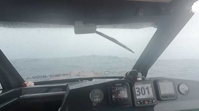
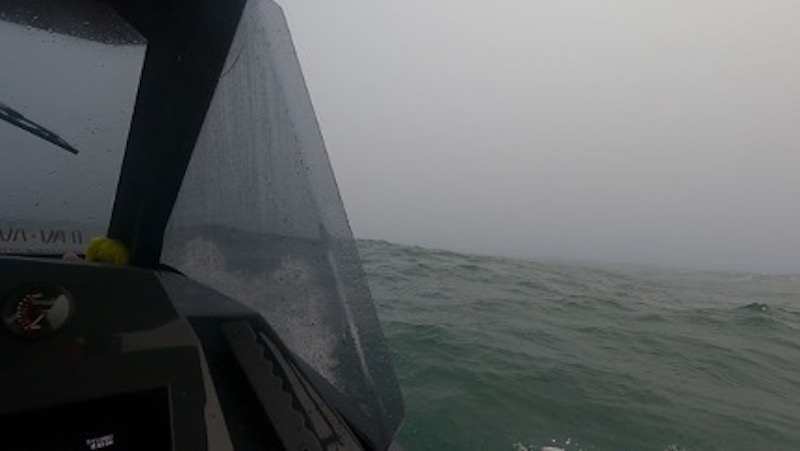
Now the waves exceeded 5 meters in height and we had them against our bow. The ocean was not doing us any favors as the waves were completely unruly. Despite the height the waves were long and we were able to cruise at about 19 knots.
However, at 3300 rpm fuel consumption was coming in at 4.4 liters (1.16 gal) per nautical mile. In order to drop the consumption below 4 liters per mile we had to increase our speed above 27 knots, we knew from pre-trip tests, but that was impossible in these weather conditions.
Time 15:30
Position 63°10'N 11°03'W
We had climbed quite a bit northward and began to put the weather on our port beam.
We pushed the engine revs up and we were now cruising at 25-27 knots. The consumption was reduced to 3.5 liters per mile. Though the weather continued to be difficult, we felt pretty good despite the accumulated fatigue of the previous days.
Time 17:30
Position 63°34'N 12°32'W
Fortunately in these latitudes it never gets dark in summer so there was no anxiety about the arrival time at our destination. And we were now traveling faster since we had the waves on our port quarter. We had more straight line cruising, but the fog had become very dense and we were traveling with the aid of radar.
Light rain, temperature 7 °C and a gloomy and pessimistic environment—but we are making headway towards Iceland.
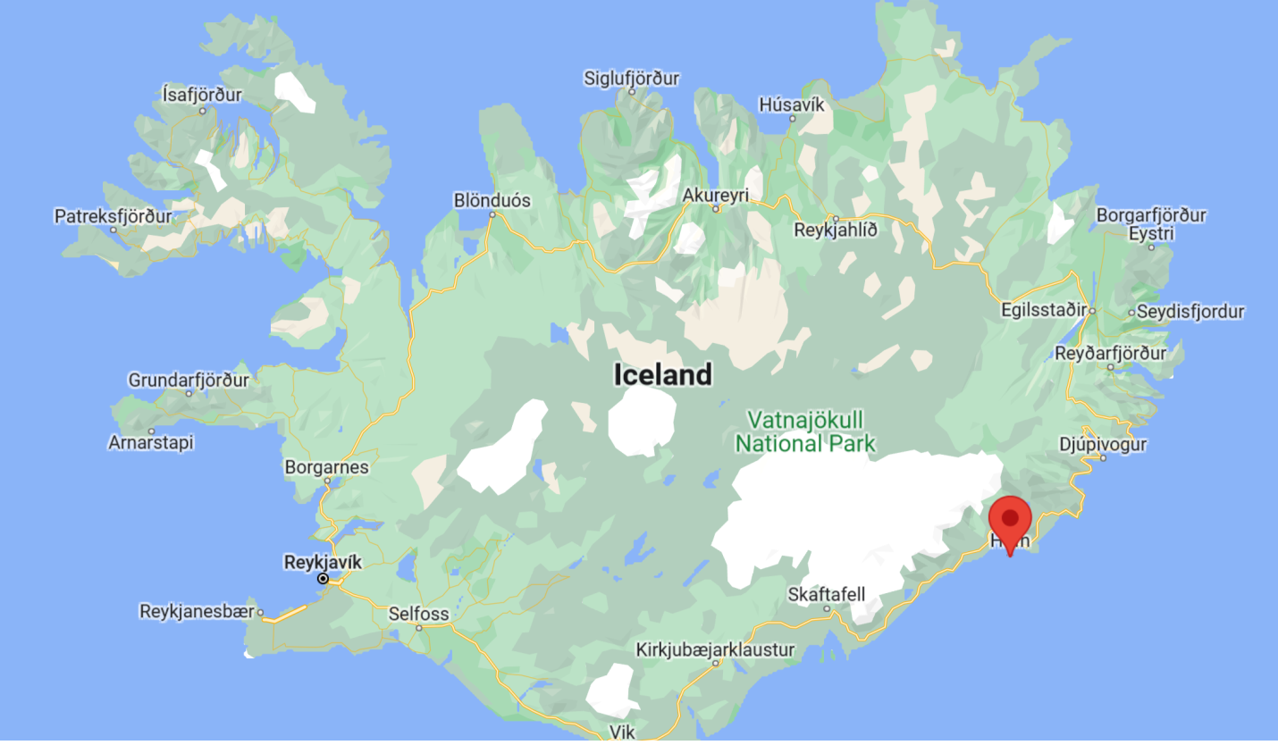
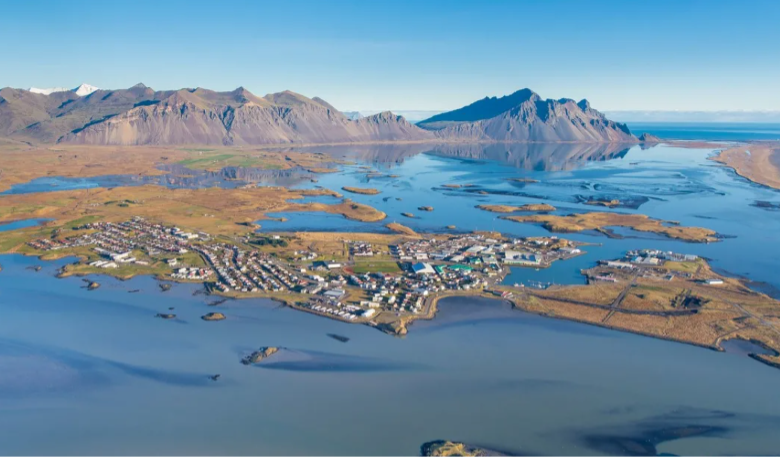
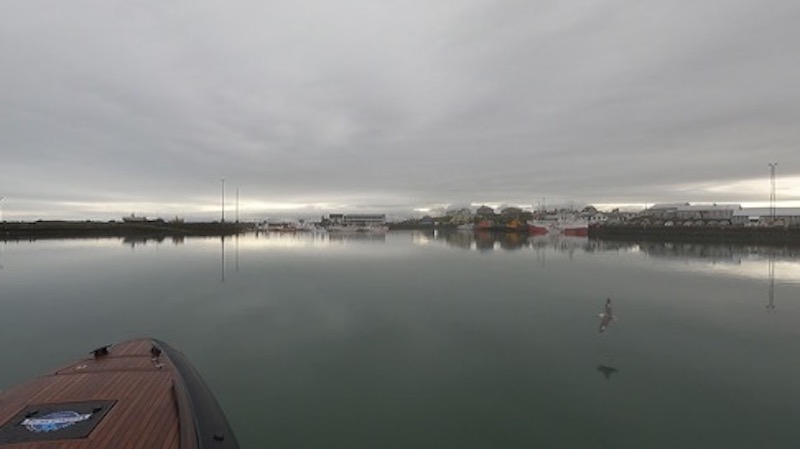
Finally, after 15 hours of riding we managed to arrive off Hofn, Iceland, at last. Höfn means "harbour" as it is the only natural harbor on the south-eastern tip of Iceland. However, the entrance to Hofn is very difficult and requires great care especially when the waters are low. The waters in the wider area are inhospitable, shallow and dangerous, while the tidal currents are very strong. Reefs are invisible, especially when it's foggy.
We stayed well away from the shore and managed to find our way in safely.
Day 8 / Sunday 10 July 2022
Position: 64°13'N 15°408'W – Hofn/Iceland
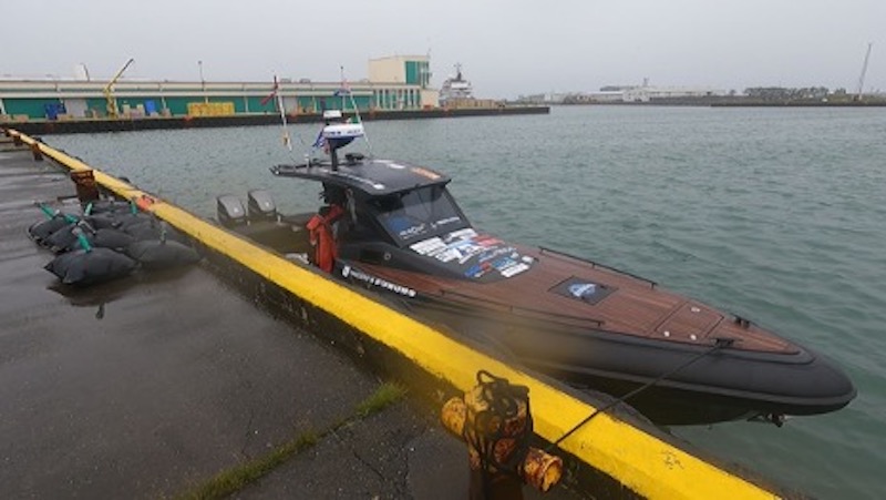
The now classic marathon to find fuel is on.
After several phone calls we found the right man who transports fuel from the gas station to the port.
The price for the transfer is 300 Euros, but since it was a Sunday, he charged us 450. We filled our tanks, paying 2.8 Euros per liter or about $10.64 USD per gallon.
In the afternoon we finished the transfusions of gasoline into our tanks. At that point, exhaustion set in, the combination of a long hard open sea run and carrying all the fuel had done us in. We had no energy for sight-seeing. After a short walk along the harbor-front we got into the cabin and put the heater on trying to warm up before falling asleep.
Day 9 / Monday, July 11, 2022
Position: 64°13'N 15°408'W – Hofn/Iceland
At 5 o'clock in the morning of the next day we set sail for Vestmannaeyjbaer islands, 160 nm further west. The temperature was 4 degrees.
Coming out of the harbor the sea was once again roiled by the tide and the headwind. It was a very rough couple of hours during which we covered only 24 nautical miles.
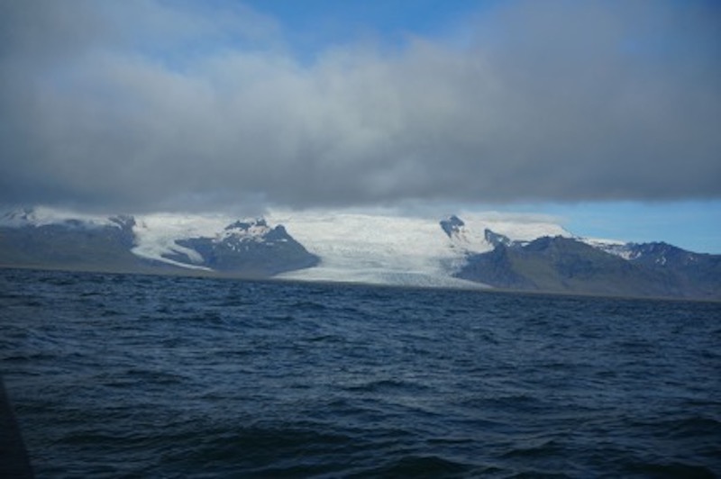
We were within swimming distance of some of the most popular attractions in Iceland—but only an Icelander would swim here. We admired the Vatnajökull glacier, which is Europe's largest, the famous Jökulsárlón Glacier, and of course Diamond Beach where black sand is strewn with large pieces of ice which take various shapes like all-white diamonds.
After that we had more laminar riding and increased speed to 23 knots. After 9 hours of cruising and a short stop at the famous Black beach, we finally arrived at Vestmannaeyjbaer Islands.
The islands have only about 4,000 people, but are linked to Iceland proper by daily flights and ferry service. The islands are famed in Iceland for the annual National Festival, which has been ongoing for over 100 years, and which attracts thousands of people. The film “The Deep” has the islands as its setting—otherwise, it’s a very quiet little spot.
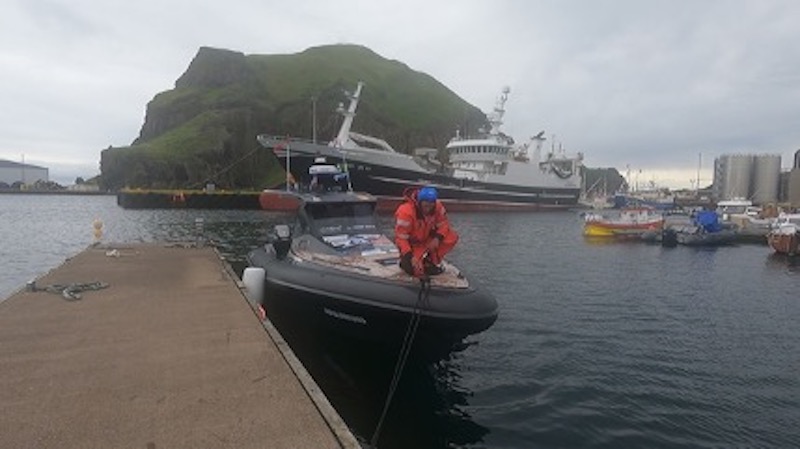
The entrance to the port is breathtaking, with the tall green and vertical cliffs offering us a breathtaking sight. We went out for coffee and intended to stay here that day.
The low barometric pressures, however, continued to chase us. Seeing the weather of the next day, we packed up running, carried fuel and in two hours we were leaving behind these wonderful islands.
Course to Reykjavik, still 120 nautical miles.
Of course, a short stop at Europe's most photographed lighthouse was absolutely necessary.
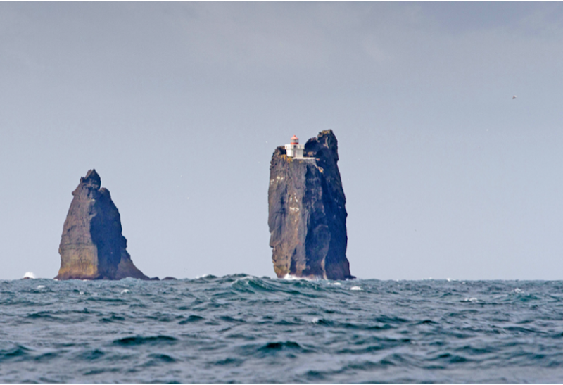
The Prídrangaviti lighthouse, built in 1938 on top of a giant vertical rock where the waves of the Atlantic furiously crash, offers one of the most amazing sights to see and graces the photo albums of many tour guides.
After we took the necessary photos of this marvel, we started again on our way.
The sea again showed us one of its worst faces. In addition, we were traveling against a strong current of over 6 knots, which we felt very strongly in our propellers as our speed suddenly dropped from 26 to 20 and even 18 knots. And of course, the headwind that made the waves jump around us, and at very close distances from each other, resulted in an even more difficult and painful ride.
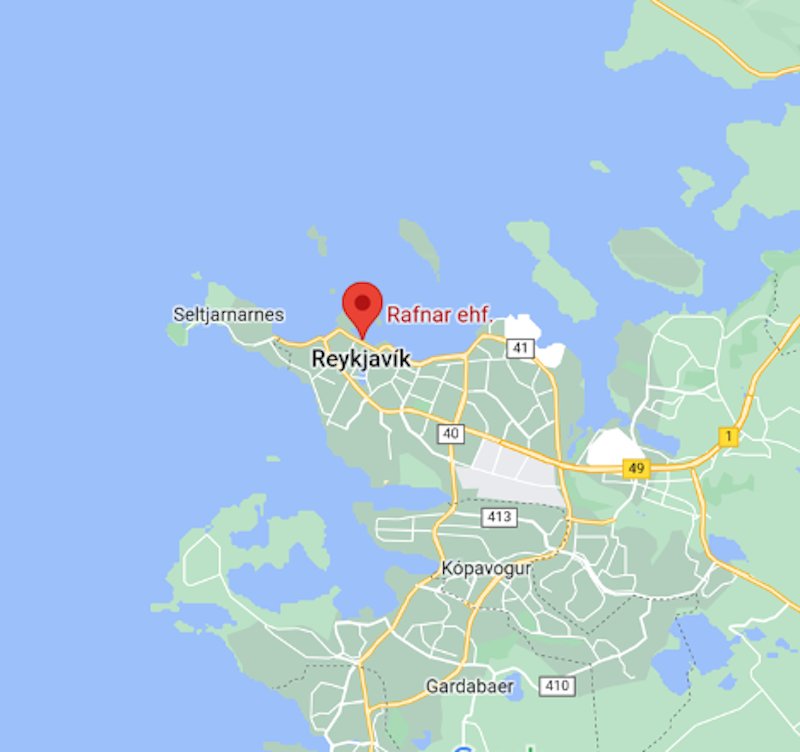
But we gritted our teeth and kept running. By the time we entered Reykjavik Bay, where we had the weather on our port quarter, we felt like marathon runners trying to break every record.
Exhausted and overworked, at 22:00 we tied up at the floating jetty of the harbor where the people of Rafnar were waiting for us.
Day 10 / Tuesday 12 July 2022
Position: 64°09'N 21°56'W - Reykjavik
With the valuable assistance of our friends, we took the boat out of the water and moved it to Rafnar's shipyard, which is located on the port. We intended to rest for two or three days getting to know the central area of Iceland. We deserved it.
So after we would regain our strength we would set sail for our next destination which was Tasiilaq in Greenland.
However, Poseidon had other plans...
Tomorrow –Trapped in Iceland
IF YOU HAVE MISSED ANY EPISODES OR WOULD LIKE TO SEE MORE CLICK HERE.