C-Map Launches High-Resolution Chart Cards
For more information, click here.
C-Map, a maker of digital marine cartography and cloud-based mapping, has launched high-detail C-Map Discover and C-Map Revel charts for Lowrance, Simrad and B&G multifunction displays.
The Discover and Reveal charts have new features including Custom Depth Shading, Shaded Relief for inland waters, subscription-free Easy Routing and more. The charts replace Insight PRO, Lake Insight HD, Precision Contour HD, MAX-N and MAX-N+ charts in the C-Map line.
C-Map Discover
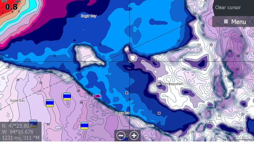
The entry-level C-Map Discover charts have all the core features and include coverage for the United States and Canada on a single card. Discover charts offer full-featured Vector charts plus C-Map high-resolution bathymetry including integrated Genesis social-map data.
The charts also have Custom Depth Shading that delivers high levels of information from underwater pinnacles and ledges plus ditches and canyons. Users can set a clear safety depth or create custom shading. The Tides & Currents feature provides projections of water level and direction of tides. Subscription-free Easy Routing automatically plots the shortest route based on chart data and personalized vessel information.
Additional features include 1’ contours on 15,000 United States and 9,400 Canadian lakes, detailed marina port plans, harbor and approach details and online updates.
C-Map Reveal
C-Map Reveal includes the attributes of Discover charts plus other premium features like Shaded Relief with seafloor and inland details. Users can view 3D rendered land and underwater elevation, including areas of Ultra High-Resolution imagery.
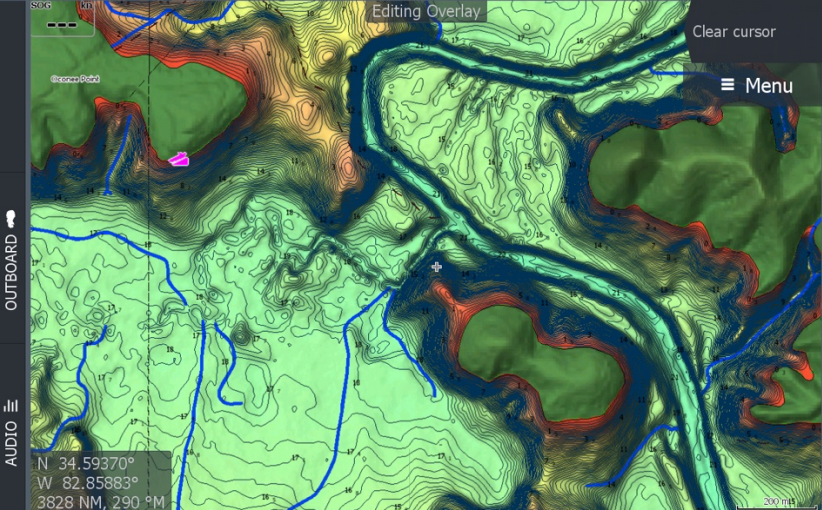
C-Map Reveal also offers Dynamic Raster Charts that bring a paper chart look and feel plus Aerial Photography that delivers an additional level of detail with photos of marinas, harbors, inlets and other navigational features. Reveal’s Satellite Overlay delivers real-world reference and enhances situational awareness for coastal navigation. Reveal charts are available on Reveal-Lake cards along with Reveal Ocean cards.
“With Reveal, boaters get extra features, including Shaded Relief, everywhere, coastal and inland,” said Max Cecchini, executive vice president of C-Map. “Previously that view was only available in our local products, in very select coastal areas.”
By moving from a complex range of Max-N and Max N+ charts to a simpler C-Map Discover and Reveal line-up, C-Map has made it easier to select a chart.
C-Map Discover charts retail at $124.99 while Reveal range from $149.99 to $249.99.