Charting Through the Years
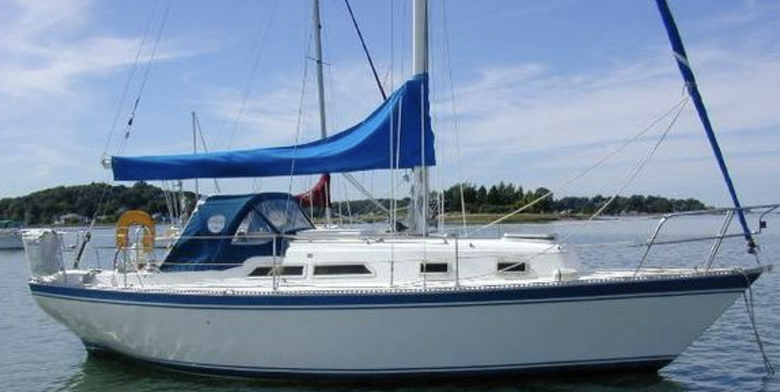
In September 1987, I sailed my 30-foot Hughes Columbia from Chesapeake Bay to Little River, South Carolina. After a few days of waiting weather, I exited the Little River Inlet and pointed the bow toward Bermuda, some 1,000 miles away.
To find that small speck in the middle of the Atlantic, I had the most up-to-date navigational instruments of the time. They consisted of a compass, a VHF radio, a sextant with complete tables, paper charts and a radio direction finder.
Seven and a half days later, I tuned the RDF to the radio signal for St. George's Harbor, and my feelings of accomplishment were beyond explanation. Flash forward to 2000, as Susan and I on our Mariner 40 Ketch, Sea Trek were planning a trip through the Bahamas, Hispaniola and Cuba.
We bought our first on-board computer with state-of-the-art navigational software and the most current electronic charts. We thought we had gone from the Santa Maria to the Starship Enterprise. Now, just 11 years later, that first navigational setup seems almost primitive.
Today, we have a full complement of electronics, including our favorite, the chart plotter. We didn't install our first chart plotter until our cruise from Houston to Beaufort, South Carolina in 2007. Once we had it onboard, we wondered how we had navigated all those thousands of miles for all of those years without one.
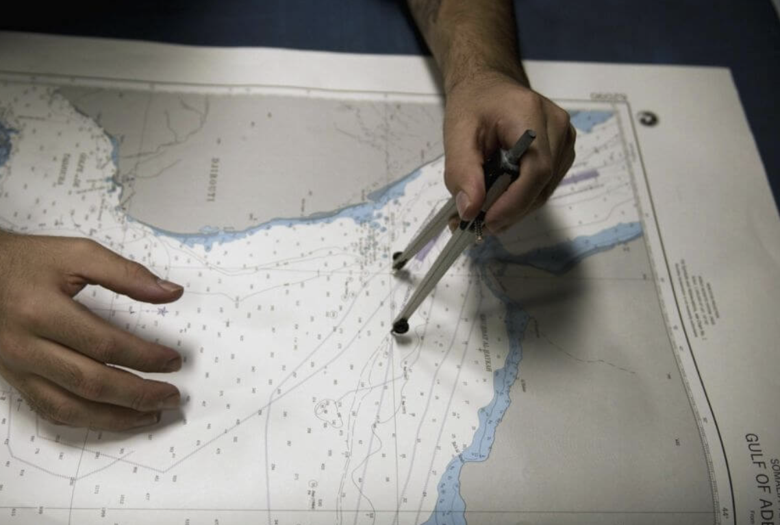
Plotters are arguably the most popular piece of electronic equipment found on boats today. The advancements of plotters and GPS integration over the past 18 years are nothing short of astounding. In the early 1990s, most all of us were still plotting our course on paper charts and using dividers, protractors, parallel rulers and a sharp No. 2 pencil.
Around 1993, all of that changed, and the race was on for high-tech, highly accurate electronic charting.
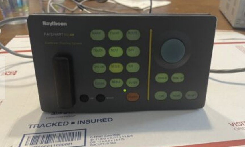
In 1993, Raymarine introduced the Raychart 600 as an add-on to its radar system. The unit displayed on a CRT screen, and the radar had to be switched off to view the crude monochrome display with little detail. In 1995, Garmin introduced the GPS Map 220. It boasted of viewing in 16 colors and retailed for more than $2,000.
These early chart plotters required expensive data cards or chips with limited storage space. A long-distance cruiser might need up to 10 or more of these chips to cover all of their navigational areas. These chips were not updateable, so to have the most current, we would often have to purchase new cards if significant chart updates had been made.
In 2003, Raymarine once again made major headway with its introduction of the C Series and E Series displays that had the ability to integrate other onboard electronics to the same screen. The term chartplotter was already becoming a thing of the past. True chartplotters are getting harder and harder to find today, as system integration becomes the norm even on small recreational vessels.
Today's multifunction displays (MFDs) can display almost every other instrument connected to the system. This includes radar overlays, wind speed and direction, boat speed, depths and much more. All of this while providing a position on the electronic chart with accuracy within feet of where your boat actually is.
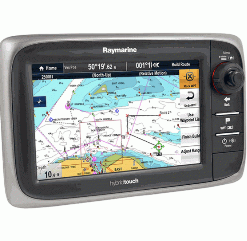
The current offerings for MFDs are as spectacular as the improvements from 15 years ago. The new Raymarine e7 series, released in July 2011, contains a dual-core processor, touch-screen technology and dedicated graphics for incredible speed and detailed display.
The e7 has built-in WiFi that will communicate with the Apple iPad, allowing it to be used as a repeater and much more.With the new LED backlighted screen, the e7 is incredibly bright and colorful, even in direct sunlight.
The e7 can be integrated with Raymarine radar, night-vision cameras, Sirius weather receivers, autopilots and other instruments and contains a 48-channel GPS receiver.Not to be outdone, other manufacturers are also bringing out some outstanding products. Simrad has introduced its new touch-screen NSS Sport Series.
The NSS Sport comes in three sizes and offers touch-screen, keypad and rotary control to provide users with a variety of controls to fit their comfort level.
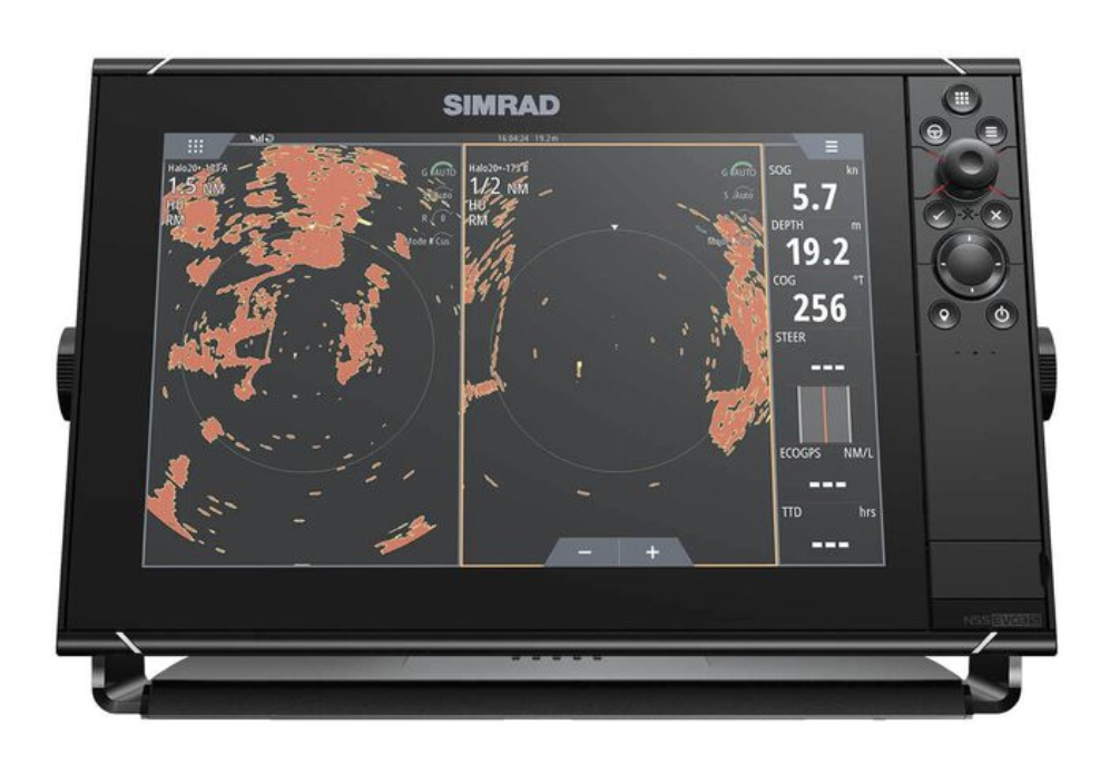
Ensuring ultimate flexibility, the NSS Sport can be networked to the Simrad NSO and NSE multifunction displays, as well as Simrad Yachting's comprehensive range of innovative performance module options, including the award-winning Broadband Radar, StructureScan Sonar Imaging, SonicHub marine audio server andWM-2 SIRIUS satellite weather/radio module.
The NSS Sport is also preloaded with Insight USA inland and coastal cartography and is fully compatible with the complete range of Navionics chart options on microSD.
Garmin's new GPSMap 6000/7000 touch-screen offers state-of-the-art G motion technology and built-in worldwide maps, XM weather radio compatibility and allows support for radar, sonar and more. The G motion technology gives the user unprecedented viewing of navigational charts.
Many of the current displays include built-in charts for the entire United States coastal and inland waters. The need to purchase individual charting chips is also becoming a thing of the past.
Satellite overlays, 3D imaging, weather overlays and video displays are but the beginning of more features, added capabilities and expansion we will see from all of the major manufacturers. As users demand more integration with other mobile devices and more computer-like capabilities, companies like Raymarine, Garmin, Simrad and others will quickly introduce new and more exciting products, a long stretch from my first sextant and radio direction finder.
A big word of caution is also needed with all of this technology. As great as these electronics are and with all of the information they can provide, they are by no means perfect. Nothing compares to a set of eyes constantly on watch for hazards and potential problems.
No display can tell you if a log is floating in your path or if channel markers have been moved due to shoaling. Blindly following a plotter is a sure-fire recipe for disaster, and overly depending on any piece of equipment for the safety and security of your vessel and crew is foolish.
We still keep paper charts on board because we have learned from experience that electronics can and do fail. When we want to look at the big picture, we can only do that on a set of the most up-to-date charts.
We use a variety of sources for information and confirmation, and years of cruising and tens of thousands of miles under our keel have taught us that anything is possible. We want you all to stay safe out there.