Cruising Block Island, RI
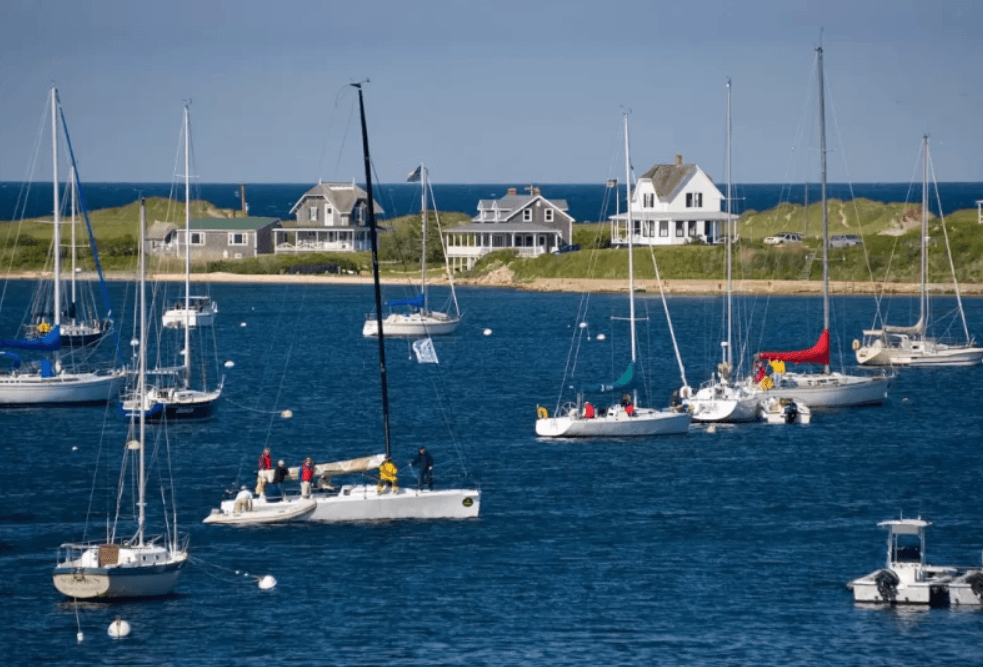
Block Island sits 12 miles south of the mainland, its tall hills and bluffs visible on the horizon in clear weather. A natural waypoint for cruisers transiting between Long Island Sound and Narragansett or Buzzards Bay, it offers a well-protected anchorage, good marine facilities, and an island atmosphere that keeps boaters coming back season after season.
The Island
Often called the "Bermuda of the North," Block Island runs just 6 miles long and 3 miles wide, with 20 miles of shoreline, high clay bluffs, and beaches largely known to seabirds and the occasional seal. Temperatures tend to run 10 degrees cooler than the mainland in summer. The island generates its own weather — fog is common near the breakwaters, while the sun can be shining on the island. A persistent southwest wind cools the island in summer but can create problems for boats anchored in Great Salt Pond.
Peak season here is busy. During the Fourth of July week, as many as 2,000 boats encamp on the island. A normal summer weekend draws 1,200 to 1,300 boats. Latecomers should expect moorings to be fully occupied, with raft-ups common and anchorage space at a premium. Block Island collects a nominal landing fee from every adult arriving by private boat or ferry, collected on the honor system via boxes at marinas and town docks.
Harbors
Great Salt Pond (often called New Harbor) is the primary cruising destination. More than 1 nm long and nearly as wide, the pond offers good depth, multiple marinas with repair capabilities, and room to anchor, though holding varies by location. The 11.5-foot MLW entry channel was cut through from Block Island Sound to the natural salt pond in 1895. Marine facilities here provide easy access to the island's beaches, hiking trails, restaurants, and lighthouses. Ferries from Point Judith and Montauk tie up regularly at marina docks inside the pond.
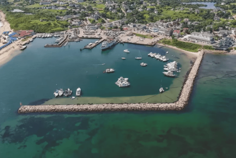
Old Harbor, on the island's eastern side, is a small harbor of refuge protected by breakwaters and not accessible by boat from New Harbor. It is the commercial center of the island and the ferry landing for Point Judith and New London service. New Shoreham, the smallest town in the smallest state in the U.S., was incorporated in 1672.
Navigation
Boats approach Block Island from multiple directions: east via The Race (21 nm), southeast from Watch Hill Passage (13 nm), southwest from Newport (26 nm), northeast from Montauk Harbor (17 nm), and south from Point Judith across Block Island Sound (10 nm).
Block Island Sound deserves respect. Easy swells can build to seas quickly, and fog is frequent. Big ship traffic will show AIS and strong radar returns; sport fishers will not. Current through The Race and Watch Hill Passage can significantly affect inbound and outbound passages.
Approaching from the west, the island may appear as two separate landmasses — Great Salt Pond nearly bisects it, and the shore on both sides is low. If approaching Old Harbor from the east or west, do not cut the corner at flashing green bell buoy "1BI" at the island's northern end. The shoal there has caught many skippers who believed they were in deep water.
The Great Salt Pond entry channel is well-marked and straightforward. The 49-foot flashing red breakwater light "4" is visible from a distance, though positioned slightly southwest of the channel itself. Red unlighted bell buoy "2" is the better starting point if local knowledge is limited. The channel runs straight to the former Coast Guard station on the west shore and into the pond.
Moorings and Anchorage
Great Salt Pond moorings are first-come, first-served. The harbormaster's launch collects fees covering trash disposal, pump-out service, and two shower tokens per day at the Fred Benson Town Beach pavilion. Light green moorings (black numbers) accommodate vessels to 45 feet; bright orange moorings handle 46- to 55-foot vessels. Private white moorings with black numbers may be available through the harbormaster on VHF Channel 12. Several marinas line the southern shore, including the 225-slip TPG Marinas Champlins, offering full amenities including a hotel, waterfront pool, dockside restaurants, cafe, poolside bar, and dog park. Payne's Dock offers slips to 300 feet with full amenities. The municipal Old Harbor Town Dock has 30 slips with limited services.
Anchorage is east of the main navigation channel in the harbor at Great Salt Pond North. Follow the well-marked channel, turn to port on green can "11," and drop anchor in 15 to 25 feet MLW. Note that anchoring is prohibited within the town mooring field, within 100 feet of a commercial dock, within 50 feet of a moored vessel, and in areas set aside for shellfish beds.
Important Note to Mariners: Great Salt Pond is a No Discharge Zone. Even treated effluent cannot be discharged overboard. Free pump-out service is available, call "Pump-out Boat" on VHF Channel 73. Call early to get on the list.
Old Port Launch (VHF Channel 68) runs in most weather and late into the evening from New Harbor Boat Basin, where dinghy dockage is available. Dinghy dockage is also offered at TPG Marinas Champlins. The dinghy dock between Payne's Dock and Dead Eye Dick's was built and donated by the Wronoski family and is removed at season's end.
For complete cruising coverage of Block Island, Rhode Island Sound, and the full Atlantic coast from Cape May through Maine, consult a Waterway Guide Northern Edition.