Cruising Florida’s Tampa Bay
One of the great natural harbors of the world, Tampa Bay extends about 25 miles north to south and about 10 miles east to west. It has two major cities (Tampa and St. Petersburg) and several large rivers that meander in from the east and north. Fringing the west side of the coast and extending northward is a pencil-thin chain of barrier islands with resort communities famous for their Gulf shore beaches.
Tampa Bay comprises three vast bodies of water–Tampa Bay proper, Old Tampa Bay to the northwest and Hillsborough Bay to the northeast–all providing excellent cruising. Lower Tampa Bay opens to the Gulf of Mexico but enjoys the protection of barrier islands. Old Tampa Bay reaches northwest from Tampa Bay to the shoal water around Safety Harbor and Mobbly Bay. Hillsborough Bay branches off to the northeast between Interbay Peninsula and the mainland to serve the city of Tampa, Ybor City and Davis Islands with their extensive shipping and industrial areas.
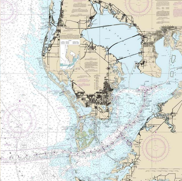
From the open mouth of Tampa Bay, St. Petersburg lies due north with metropolitan Tampa to the northeast. Each dominates one of the two big peninsulas that pierce the bay. Pinellas to the west extends about 45 miles from the southern edge of St. Petersburg almost to Tarpon Springs. MacDill Air Force Base occupies the southern tip of Interbay, the second peninsula (about 3 miles wide and 10 miles long).
For the cruising skipper Tampa Bay is a welcome change from the confines of the GIWW. Here there are some 300 square miles of cruising waters, Gulf fishing, interesting ports, pleasant anchorages, good yacht facilities and superb sailing.
No Wake Zones, Idle Speed Zones and various Speed Limit restrictions are in effect throughout the waterways included in this article.
Anna Maria Island–GIWW Mile 89
Lovely Anna Maria Island is noted for its white sandy beaches, good tarpon fishing and premium restaurants. The island lies between Sarasota Bay on the south, Anna Maria Sound (separating the island from the mainland at the towns of Cortez and Bradenton) and Tampa Bay on the north. Cruisers can reach Tampa Bay and points north either directly from the Gulf of Mexico or via the inside GIWW route from Sarasota Bay.
Egmont Key–GIWW Mile 95
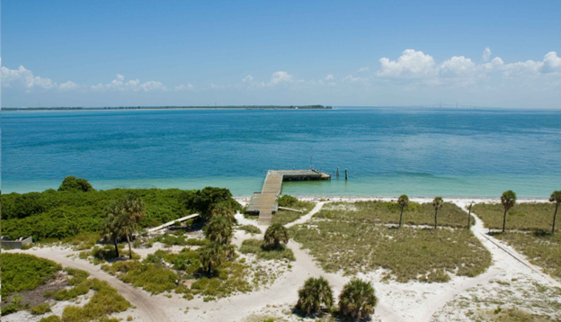
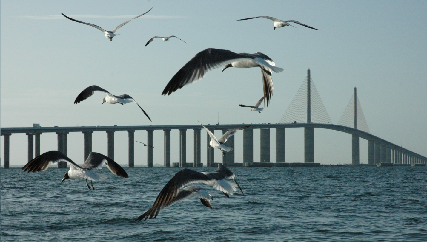
Square in the middle of the entrance to Tampa Bay lies Egmont Key, 3 miles off the tip of Anna Maria Island. The island is a bird sanctuary and you will also see a lot of gopher tortoises, which are on the endangered species list. Unfettered wandering is discouraged. Egmont Key is a popular daytime anchorage that gets crowded on the weekends in the summer. You can anchor close to shore on the southeast end of the island and dinghy in. As an overnight anchorage the waters on the east side off Egmont may be uncomfortable when an evening breeze kicks in and creates a lee shore. The bottom is hard sand with good holding.
Tampa
To get to Tampa from The Bulkhead at the exit of Anna Maria Sound set a course of 022° magnetic for flashing red buoy "70" well out in Tampa Bay at GIWW Mile 95. Continue on the same heading until you pick up quick-flashing red buoy "26" at Mullet Key Channel, the big ship route up Tampa Bay. Go under the center spans of the Bob Graham Sunshine Skyway Bridge (known locally as the Meisner Bridge). You may then follow the Mullet Key Channel the 20 to 25 miles all the way northeast to the City of Tampa.
Most of the marine facilities are on the Seddon Channel between Harbor and Davis Islands. At the end of Davis Islands is a park that offers a small beach area, off-leash area for dogs, picnic area, canoe launch and boat ramps.
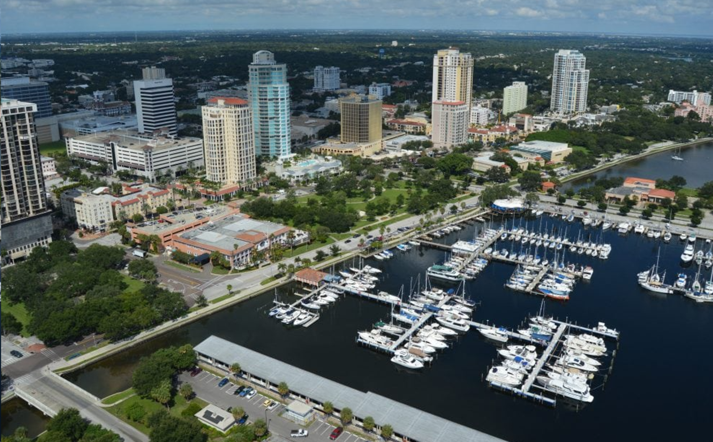
City of St. Petersburg
Facilities of one kind or another line all sides of the peninsula in St. Petersburg (often referred to as St. Pete). Boaters heading up Tampa Bay reach the marinas at the south end first but there are also facilities downtown on the east side of the peninsula and in Boca Ciega Bay on the west side.
Two routes, both clearly marked on NOAA Chart 11416, lead from Anna Maria Sound to St. Petersburg. Starting from The Bulkhead set a course of 022° magnetic for flashing red "70" well out in Tampa Bay at Mile 95. Continue on the same heading until you pick up flashing red buoy "26" at Mullet Key Channel, the big ship route up Tampa Bay.
The western approach to St. Petersburg follows Mullet Key Channel eastward through the high-rise Bob Graham Sunshine Skyway Bridge. Leave the channel at flashing green buoy "3B" with a bearing of about 5° magnetic. After leaving a 27-foot-high quick-flashing red to the east you should pick up the twin, 16-foot-high flashing green "1" and flashing red "2." At quick-flashing green "3" continue north on the marked channel to access the facilities on the east side of the peninsula.
You can head into Bayboro Harbor at flashing green "S." Coast Guard ships and cruise ships come here so the water is deep. Keep north for the marinas at the three yacht basins (North, Central and South).
To continue to Boca Ciega Bay, turn west to flashing green "1" and take the channel under the 65-foot fixed vertical clearance span of the Maximo Bridge until it converges with the northbound channel to St. Petersburg at red daybeacon "14."
Be advised that if you are are exiting Boca Ciega Bay and hoping to avoid easterly winds out in Tampa Bay you will have them right on your nose from green daybeacon "13A." It is several miles to the northbound channel.