Exploring Minor Ports in Maine
By Frans Kok & Mary Shirley
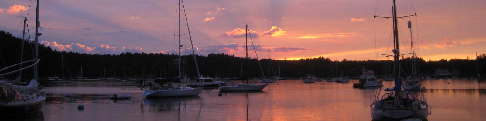
The stretch of Maine that roughly comprises the middle third of the state's coastline is one of the most fabulous cruising areas on the eastern seaboard. My wife, Mary M. Shirley, and I have cruised the region many times on our Hinckley 59 Sou'wester, Remedios.
In this article, I'll skip over the area's best known harbors --- Camden, Boothbay Harbor --- and instead focus on some of the lesser known ports Mary and I visited on a recent trip. While not exactly undiscovered, these places are quieter, less touristed, and more remote than the region's usual spots. That is, after all, why we have boats: to go places our landlubber friends can't easily reach.
FRENCHBORO, LONG ISLAND
Frenchboro, on Maine's Long Island, is one of my favorite harbors. It narrows like a funnel, and the mooring field is snugged in between the island's high hills. You need a mooring to spend the night, but it is impossible to make reservations for them. Instead you pick up a mooring when you arrive and pay at the town's lobster pound. We've never had a problem getting a mooring, though at times it has been a tight squeeze.
During this particular visit, we cast off from the dock at Southwest Harbor at about 1:30 p.m. Frenchboro's harbor was already full of boats when we arrived, so we took one of the outermost moorings. We then called Brody, an enterprising and engaging pre-teen boy from the area with whom we'd dealt before. His mom, Tammy, cooks lobster for visiting boaters, and Brody delivers the lobsters directly to the vessels. We ordered two peelers and soon Brody dropped them off, with corn on the cob on the side. Mary and I feasted under fabulous stars. After lazing around until 11 a.m. the next morning, we went ashore to explore the local church's annual lobster fest. More than a thousand people arrived by ferry for the festival from neighboring islands.
MERCHANT HARBOR
The next morning we awoke to rain and strong winds. We took the dinghy to town and stopped by the local store for provisions, then set off to circumnavigate the island by foot. Later that afternoon, as we motored back to Remedios, we saw that she had moved about 300 feet toward the rocks! At first we thought she was aground but then found she still had 15 feet of depth. Nevertheless, we decided to weigh anchor and head to Merchant Harbor.
On our way over to Merchant Island we got blasted by gusty winds and four-foot seas, but once in the island's lee everything was tranquil. We reached the harbor, totally exhausted. We ate some dinner and then both of us were in bed by 8 p.m. When we awoke the next morning, I remembered why, to my mind, Merchant Harbor is so precious. There are usually no more than three or four boats at anchor and there are no moorings available.
For lunch we bought peelers from Ahab, the same lobster boat we'd bought lobster from the year before. We highly recommend buying lobsters directly from the lobstermen if you ever get the chance, as the lobsters are cheaper than onshore, the fishermen appreciate the cash, and the exchange eases some of the tension between pleasure boaters and working fishermen.
SEAL BAY, VINALHAVEN
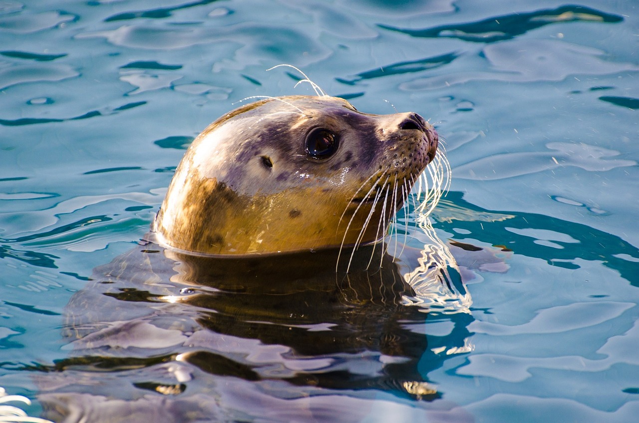
When we lifted the anchor at about 10 a.m. the next morning, we were shocked to find no mud on the anchor or chain. We must have been in grass, with only the 200-foot chain keeping us in place, but the harbor is so well protected that we hadn't moved at all. We left Merchant Harbor in light winds and sailed toward the tricky entrance to Seal Bay on the island of Vinalhaven. It was low tide when we arrived, and we slowly picked our way into the bay past all the rocks and ledges until we found somewhere to drop anchor. There are only private homes around Seal Bay so there is no way to go ashore but the anchorage is spectacular. And there are lots of seals!
ROCKPORT
The next day we got off to a late start because of thick fog. We motored out of Seal Bay's treacherous entrance, then set sails in 10-knot SW winds and drifted slowly to Rockport. When we reached Rockport, the harbormaster directed us to a mooring and complimented us on looking very pretty as we were sailing in, always nice to hear. We got tokens for the shower (eight minutes!), then later on his advice took the dingy to Atlantic Challenge, a dock on the north end of the harbor, to get provisions.
Rockport is larger and more touristy than any of the other ports we'd visitied on this cruise, but the harbor is still quiet and lovely. We had scallops for dinner and watched the fog lift to reveal the town's twinkling lights.
BUCKS HARBOR AND CRADLE COVE
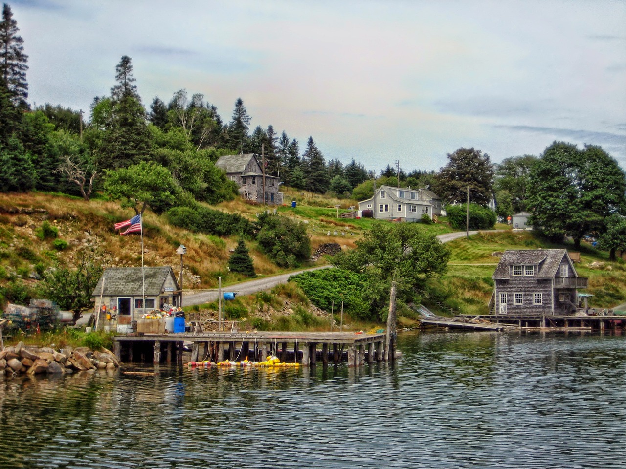
As we made our way from Rockport up through Penobscot Bay to Belfast, we stopped at two spots worth mentioning. The first, Bucks Harbor, is a true hurricane hole, protected by Harbor Island. Once inside the harbor, the water is very quiet and you are surrounded by high hills. Fuel, water, and a limited selection of groceries are available at the dock.
The other stand-out spot, Cradle Cove, is just off 700-Acre Island. There is a negligible year-round population on the island but it has about 20 beautiful summer homes and a two-mile-long road that bisects the island. You can land at Dark Harbor Marina, take a shower, pay for the mooring, and take a hike on the island. Just stay on the dirt road as all the property is privately owned.
BELFAST
Belfast turned out to be an easy harbor to enter, with a fairly large mooring field where the boats were well spaced. We went ashore to explore the cute town and its small shops selling woodwork, candles, and other crafty items. A fleet of antique cars rolled through town, honking their horns. One of them was a 1965 Mustang, the same model I'd owned as a student in the 1960s. Belfast is a real throwback in time, in the best sense of the word!
WINTERPORT
We motored out of Belfast's harbor and scooted up the bay to the Penobscot River. This is Maine's second-longest river and was once heavily travelled, bringing logs and goods to and from Bangor. It is deep and narrow, with hilly shores. We entered the river for a terrific cruise of about 15 miles. We passed the industrial town of Bucksport and continued to tiny Winterport, dominated by old waterfront cold-storage sheds and church spirals.
We picked up a mooring in front of the tidy marina. The river raced by but the mooring was strong and the place was lovely, with an excellent view of the wooded hills downriver and nothing on the far river bank. We wandered through town and marveled at all the once-grand crumbling buildings, relics from when Winterport was an important part of the Penobscot Bay's then-mighty transport corridor. Back on board, we made crab cakes for dinner, then sat on the stern admiring the starry sky and the half-moon that rose behind the far shore.
STOCKTON HARBOR
The next morning we started early to take advantage of the outgoing tide. An hour later, we arrived at the mouth of the Penobscot River. From there we motored in light winds to large, well-protected Stockton Harbor and picked up a mooring. We went ashore and after walking for about a mile and a half, passed a house where a man sitting on his porch told us that the store was about a quarter of a mile away, so we pushed on through the heat, only to discover that the store was more like a mile and a half away. The miserable shop had very few provisions, but we did buy a bottle of red wine for dinner and some water for the long, hot walk back to the harbor. Later I took a swim, and then Mary and I passed a nice evening beneath our mosquito netting, until we were awakened at 3 a.m. by the noise from the nearby chemical plant. All in all, a nice harbor, but not our favorite.
ORONO ISLAND
We left at about 9 a.m. the next morning and motored around the bluff into Eggemoggin Reach. We always have a nervous moment when we reach the bridge there, as its clearance is 85 feet and we stick up 83 feet. This time Mary noticed a red sign and lots of activity on the bridge, and with our binoculars we saw that the sign said, "Warning, Reduced Clearance. Uh, oh! As we drew nearer we couldn't really tell if we'd make it, until with a sigh of relief we passed under it. We'd planned on entering Mackerel Cove on Swan's Island, but on our way there saw some private moorings east of Orono Island.
Despite Mary's usual protestations about using unknown private moorings, we decided to stay for the night. It was a spectacular spot, surrounded by wooded islands. The next morning we were supposed to head back to Southwest Harbor, but the forecast called for boiling temps in the 90s and air pollution, so instead we stayed put one more day in the Orono Island spot, where there was no such thing as air pollution, and low water temps kept things relatively cool. We had a beautiful lazy day, and a great end to a wonderful month cruising the unknown harbors of Maine.