Hurricane Hunters
By James R. Barnett
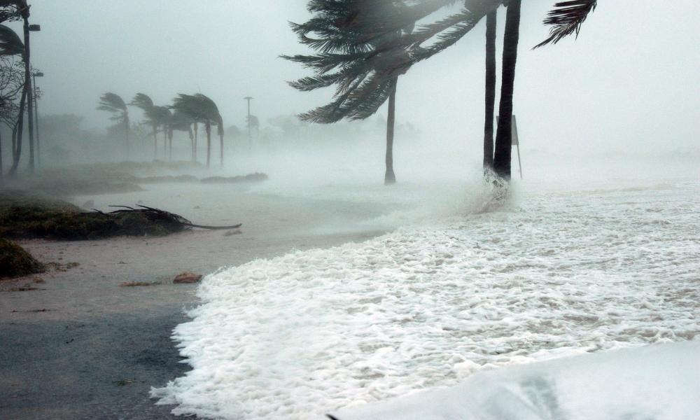
Hurricanes are nature’s grandest, most ferocious storms. They fascinate us, and they repel us. As a radio news and weather reporter in Miami for 30 years, my grandfather was obsessed with hurricanes. (Confession: I am, too.) Using colored pencils and a wooden ruler, he meticulously plotted their paths onto an enormous paper map tacked up on the wall of his study. It was a beautiful and mesmerizing record of these ferocious and complicated storms that somehow feel alive as they zigzag and wobble across the ocean like drunken sailors.
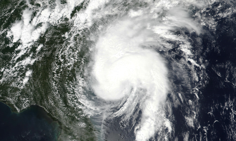
Science has improved dramatically since my grandfather’s era. A fleet of Earth- observing satellites providing real-time data now help thousands of scientists around the world answer three age-old questions: Where and when will the hurricane hit and how strong will it be? Modern forecasts are pretty accurate. Long gone is the day when a storm could sneak up and hit without any warning. Here are the stories of three men who helped pave the way.
THREE WHO PAVED THE WAY FOR HOW WE TRACK & PREDICT HURRICANES TODAY
FATHER HURRICANE
When the regime of Queen Isabella II of Spain collapsed in 1868, many who supported her thought it wise to flee the country. Father Benito Viñes, a Jesuit priest and educator, was one of them. He emigrated to Cuba and found a position as director of the meteorological observatory in Havana. Shocked by the damage hurricanes regularly inflicted upon the island, he made it his mission to learn everything he could about them.
Within five years of arriving, Father Viñes knew more about hurricanes than any living person. He was the first to discover that the cloud pattern and the behavior of the wind well in advance of a storm could be used to track it accurately. Using this information, he designed the “Antilles cyclonoscope,” a kind of slide-rule that could estimate from a considerable distance the current position of a hurricane and calculate its likely path. Up until then, weather observers could tell when a hurricane was coming but not where it was going.
His first forecast was published in a Havana newspaper on September 11, 1875 — two days before an intense hurricane ravaged the southern coast of Cuba. Many lives were saved because of the timely warning. Throughout the 1880s he exchanged hurricane information with other weather observers across the Caribbean via telegraph. It was the first hurricane warning system and a model the United States. Weather Service later emulated it. Father Viñes was so well-respected that for a short time hurricanes were even called Viñesas and identified numerically. The pronunciation, however, was difficult for Americans, so the practice ceased. Father Viñes died in 1893.
THE AERIAL ACROBAT
Len Povey was a self-taught pilot who flew with the new U.S. Army Air Service until 1922 when he left to pursue a more “colorful” career testing race planes, flying bootleg liquor and barnstorming over the Great Lakes as a headliner with a flying circus. His aerial acrobatics at the All-American Air Maneuvers show in Miami in 1934 caught the eye of a Cuban Air Force official who hired him to train Cuban pilots and serve as the personal pilot for Fulgencio Batista, the chief of the armed forces and later president and dictator of the island nation.
When Cuba’s Weather Service detected a storm intensifying several hundred miles east of the island in early September 1935, Len Povey volunteered to help pinpoint the location and movement of the storm. He jumped in his Curtiss Hawk II, an open cockpit biplane, and flew over the Straits of Florida where he located the hurricane farther north than predicted and moving northwestward toward the Florida Keys. The Cubans dispatched a warning, but it was too late. Later that same day, the storm roared ashore at Islamorada, FL, with winds of 200 m.p.h. and a 20-foot storm surge that drowned more than 400 people, mostly Army veterans who were building the Overseas Railroad.
Povey later joined the faculty at Embry-Riddle, a private Florida college focused on aviation and aerospace programs, where he was a tireless advocate for aerial hurricane patrols. However, the type of reconnaissance mission he envisioned didn’t happen until July 1943, when Air Force Colonel Joe Duckworth flew a plane directly into the eye of a hurricane churning toward Galveston, TX. Len Povey died in 1984. His obituary claimed he survived a mid-air collision and an encounter with a turkey buzzard that sheared off a portion of his plane’s wing.
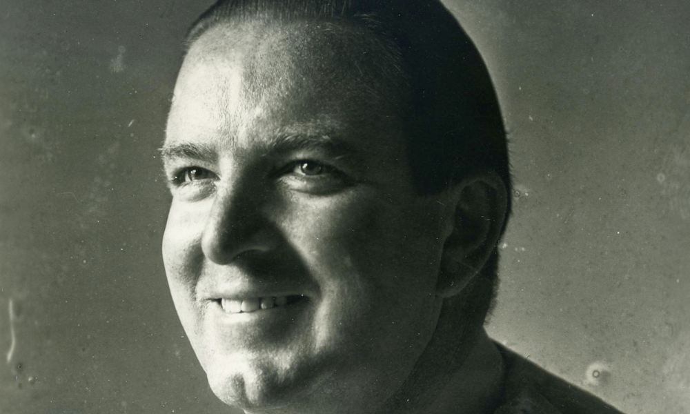
THE DATA CRUNCHER
One of the most recognized voices on hurricanes in the late 20th century emanated ironically from a mile-high lab at Colorado State University. That voice was Dr. William Gray, a professor of tropical meteorology from 1961 until 2005.
Bill Gray grew up in Washington, DC, wanting to be a baseball player. He was a standout pitcher for George Washington University until he hurt his knee. During service in the Air Force, he turned to a career in climatology. He once told the Los Angeles Times he was inspired to study hurricanes after he flew a plane through one off the east coast of Florida in 1958.
Dr. Gray was an outlier when it came to hurricanes. He eschewed computer modeling, focusing instead on observational science: historical storm data, old maps featuring storm patterns, and statistics on wind speed, water temperatures and other meteorological factors. He was the first to determine that the intensity and frequency of storms in the Atlantic was cyclical and that likelihood of a hurricane reaching the East Coast of the United States depended on a variety of factors including the amount of rainfall in Africa and the impact of El Niño (the periodic warming of the Pacific Ocean that produces powerful winds that shear off the tops of storms developing in the Atlantic). In short, he figured out Mother Nature’s recipe for powerful storms.
In 1984 Dr. Gray unveiled the first Atlantic seasonal hurricane forecast and quickly became a hurricane superstar and media darling. He, however, considered his greatest legacy the students whom he taught and mentored, many of whom went on to become leaders in weather research and forecasting. He died in 2016.
Check out Marinalife's recent article about How Hurricanes Get Their Names.
HURRICANE TRACKING APPS FOR YOUR PHONE
You don’t need all six of these apps, but we’re certain you’ll find one here that you like. All are available on Google Play and the Apple App Store.
THE WEATHER CHANNEL
Rain radar, storm tracker and severe weather warnings help you prepare for hurricane season, as well as storms and heavy rain. Monitor live radar updates, an hourly rain tracker, storm radar news, and local weather forecast on the go. Free. Available in English and 30 other languages.
NATIONAL HURRICANE CENTER DATA
Official data, custom graphics, updates and maps from National Hurricane Center (NHC) experts. Considered the grandparent of all hurricane trackers. Free. Available in English and French.
WEATHER UNDERGROUND
Reliable, real-time and hyperlocal forecasts combining data from 250,000+ personal weather stations and a proprietary forecast model provide an incredibly accurate local forecast. Interactive radar and customizable severe weather alerts. Free. Available in English and 30 other languages.
CLIME
Previously called NOAA Radar, this is a good hurricane tracker app, because it lets you overlay rain, radar or satellite images on top of the tracker. This gives you a detailed look at what’s happening in the storm. Add multiple locations to the map to get alerted if you’re in the path of a hurricane. Free. Multiple languages. Paid upgrade packages available.
RADARSCOPE
If you’re willing to spend some money on an app favored by weather nerds and professional storm chasers, then check out RadarScope. The learning curve is steeper than with others, but it features high-resolution radar data sourced from NOAA’s next generation radar and Doppler Weather Radar. Available in English, French, German and Spanish.
HURRICANE – AMERICAN RED CROSS
Monitor conditions in your area or throughout the storm track, prepare your family and home, find help and let others know you are safe. Free. Available in English and Spanish.