Loran is Coming Back
By Dag Pike
Loran was not as accurate as GPS but at least it gave you a position with enough accuracy to enable you to navigate around the coast and even out into the ocean. I recollect crossing the Atlantic and still picking up the Loran signals over 1000 miles from land. The position given was not very accurate, probably within 3 or 4 miles but in the open ocean that is enough, and the accuracy improved as you closed the land.
e-Loran
Loran was switched off once GPS became firmly established but now there are plans to bring back an updated version of Loran, called e-Loran, which promises accuracy that is close to that of GPS. So why do we need two-position fixing systems when we have got used to relying on just the one?
A question of national security.
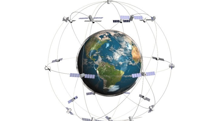
At sea, we use GPS primarily for position fixing but because it can offer a very accurate time as well from its atomic clocks, it is now used in virtually every electronic control system and virtually all public and private utilities rely on it. GPS was set up as a military system and the military is still heavily dependent on it as well. If GPS goes down the World will practically come to a standstill, so GPS has become vital to modern-day living. GPS can be susceptible to jamming and spoofing and there is always the risk that the ‘bad guys’ could interfere with the system and virtually stop the world from going round.
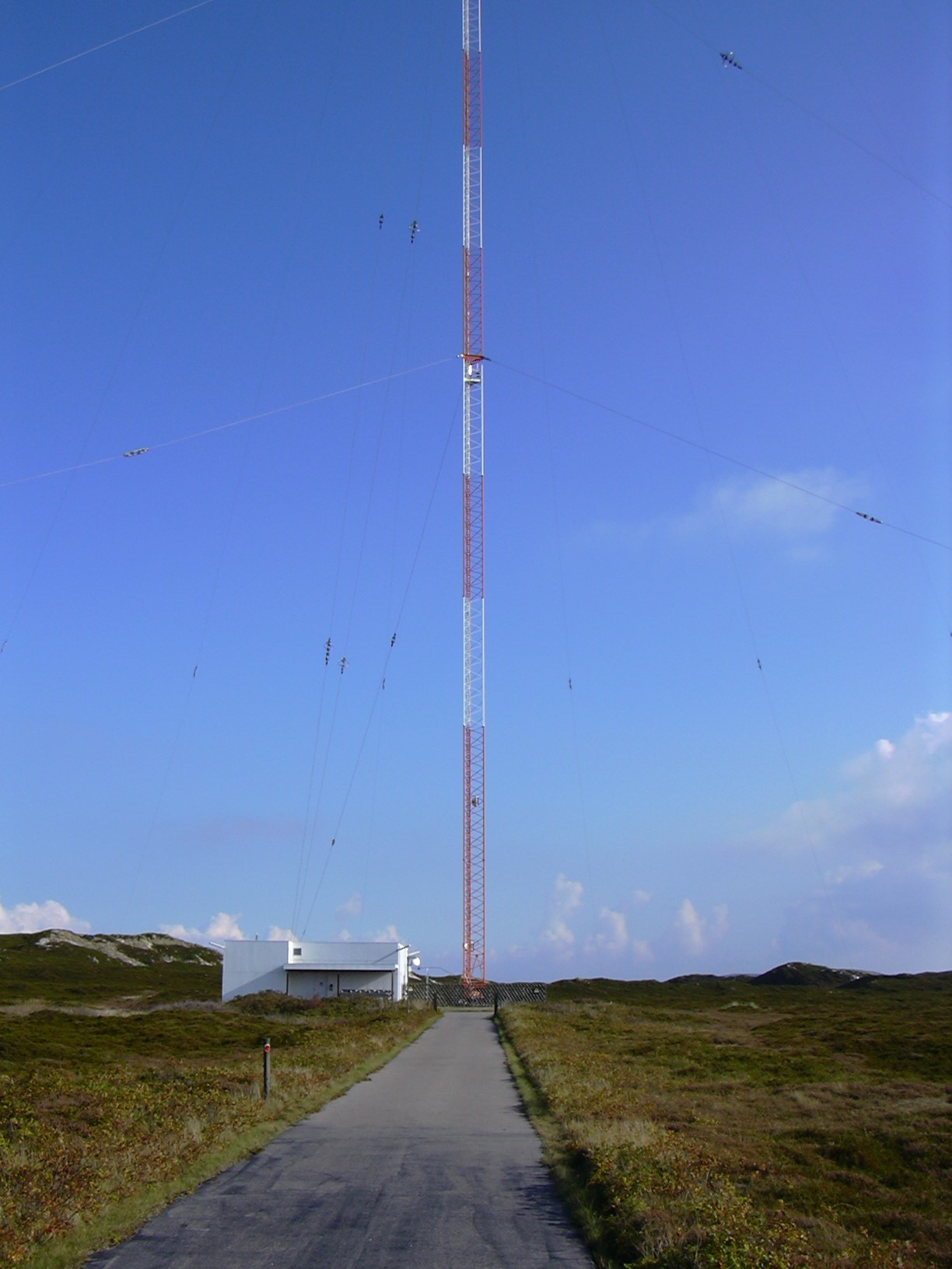
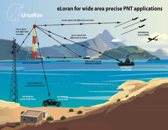
So, plans for a back up have been authorized and e-Loran is the chosen system. Being land-based and, like the old Loran, operating on longwave transmissions which are much harder to jam, it can provide a viable back-up both for position fixing and for timing. Quite when it will become operational is not clear yet, but we could see e-Loran hit the market in a couple of year’s time. So, what do we, as boating people need to do about it?
If you are in the market for a new GPS or chartplotter, you might want to consider one that can receive both GPS and e-Loran signals so you are prepared for the future. At present these are available, but they are mainly big ship stuff that is both expensive and too large for yacht use. I am sure that most of the electronic majors have designs in the pipeline for yacht equipment but these are not likely to appear until e-Loran is up and running so whilst you might want to think about a dual receiver it would be best to wait until a bit more certainty arrives in the market and of course prices will drop once the market develops.
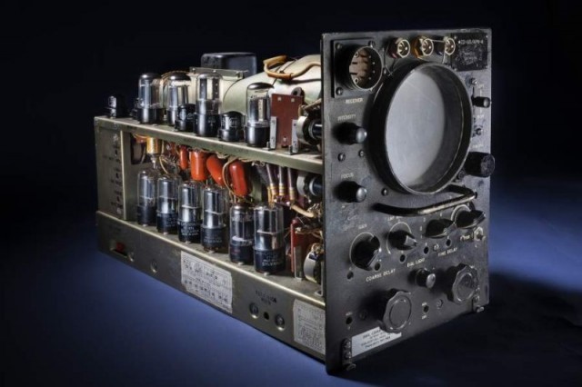
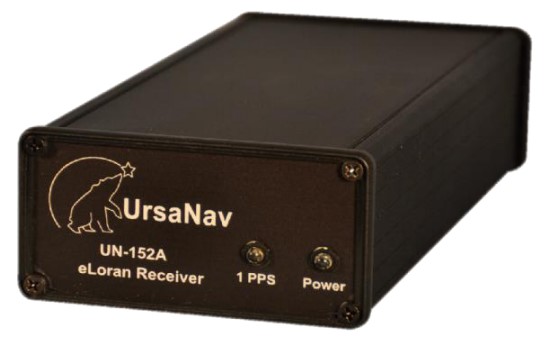
e-Loran Receivers
Because it operates on very longwave frequencies, any e-Loran receiver is likely to require its own antenna to bring the signal into the unit. Longwave frequencies tend to require a long antenna but I am sure that the developers will find ways of reducing the size so yacht installation should not be a problem, but it is one more thing to think about. e-Loran operates in a form of differential mode which entails taking the incoming signal and referencing it to a known position in order to upgrade the accuracy which of course adds to the complication. Despite all this, e-Loran can come close to the position accuracy of GPS and we all know how good that is.
E-Loran will take advantage of modern electronics with its incredible miniaturization, so I don’t see any problems with developing compact dual system receivers. They may be a bit larger than what we see now. My best guess is that they will be offered with a ‘switch' that will enable you to receive one of the other position fixing signal from either GPS or e-Loran and I can’t help thinking that this is where the problems might start.
When you have positions coming from two different sources and they both show the same position then you can feel comfortable that the position information you are getting is accurate and you can navigate with confidence. However, this raises the question of what do you do if the positions from each system are different? Which one do you believe? Its quite easy if you are only getting a fix from one system and the other is down then, of course, you are back to the position of just having the one system.
When both systems are up and running but showing different positions, you might suspect that spoofing is going on. GPS with its very weak signal is easy to jam and we know that spoofing has taken place whilst e-Loran is much more robust and more difficult to interfere with. Any attempt at jamming would stop the GPS signal and no position would be shown or perhaps it might be a dead reckoning position which the receiver will indicate. It is this dead reckoning position that could lead to two different positions being displayed but hopefully the receiver will show that the GPS is dead reckoning rather than an actual position so then you go with the e-Loran position.
When it comes to spoofing, from what we have seen with GPS, you get what looks like a viable position and this is where the two positions could differ. We don’t know much about the possibility of spoofing e-Loran but with the receiver showing two different positions which one are you going to believe? This could be the navigator’s dilemma and maybe the receivers will have some way of showing which is the correct position. We just don’t know enough about e-Loran at this stage to make a judgment but hopefully, there will be a way to resolve the conundrum.
The other alternative is to have three ways of fixing the position and then you can have a voting system and go with the majority. That is what aircraft used to do when they relied on inertial navigation to find the way and the majority won the day with two against one.
It seems we still have a lot to learn about the future of navigation, but the best way to resolve this would be to go back to basics and check out the position of your boat by the old means. Visual navigation from the coastline or from soundings was always a good solution whilst out at sea, using a sextant gave results just like the Navy is starting to do again. GPS has made us navigators lazy and maybe the time is coming to get active and check and double-check that we are getting good quality position information.