Making a Landfall
By Dag Pike
These days with GPS as your guiding hand, making a landfall should be straightforward and easy. You will have accurate positions on your way into harbor or approaching your anchorage, and everything should be positive and easy. Before we had the luxury of GPS, making a landfall was the highlight of the navigation challenge.
You might pick up the faint images of land on the horizon long before you got close. You would then focus on finding out where you were along the coast and where you expected to make the landfall. It was a bit of a hit and miss, but it was the critical part of making the transition from open water navigation to being up close and personal with shallow water and the land.
Techniques
The techniques that we used in those days for making the landfall are still valid today. It is not so much the accuracy of the GPS, you tend to take that for granted and it is hard to argue with. It is the accuracy of the charts on which the position is being plotted that should cause you concern. You as the navigator have to marry these two levels of accuracy together to make a safe landfall.
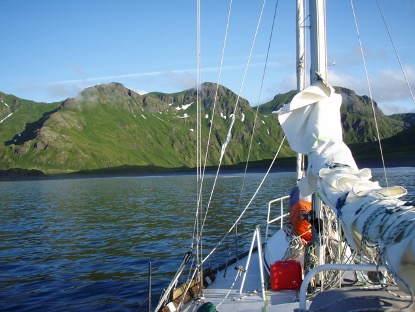
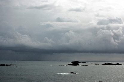
There are many situations where you come into from seaward to make a landfall. It could be after a long open sea passage, it could be coming into an anchorage for lunch, or it could be making harbor. These will be the times when you move into shallow water and where, if you keep going blindly on, you hit something hard or run aground. With GPS operating and the depth sounder running, you should be in control of the situation. But, poor visibility or the possibility of uncertain chart information could raise the risk levels of making a landfall.
Electronic to Visual Navigation
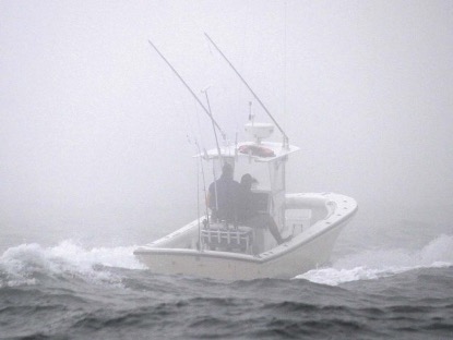
You can feel the palpable sense of relief when you sight the lighthouse or other significant mark at the entrance, and you make the transition from electronic navigation to visual navigation. It is when you are making you landfall at a headland or along the coastline where the visibility might be restricted that you need to employ navigation tactics to reduce the risks of closing the land.
One way to reduce these risks is to vary the angle at which you approach the land. Of course you will have your sounder going to give you early warning of shoaling. But if you are heading straight in towards the dangers close to the land and the unexpected happens, such as sudden shoaling or sighting rocks ahead, then you have two options about which way to turn to get out of danger, left or right.
There will probably be little or no indication about which is the best way to turn when the sounder suddenly shows danger. Which ever way you decide, you will need to make a 180 degree turn before you start to head away from the danger. This could be the longest turning circle you make because you may not be sure what is on either side of your track.
Approaching the Shallows
You can take a lot of the guesswork out of the situation if you approach the shallows at an angle of around 45 degrees. Not only will this slow down your approach into the shallows, but it will also remove the dilemma about which way to turn when the water shoals. If you adopt this angled approach, there is only one logical way to turn. The turn itself will be much less acute, so you will resolve the situation a lot quicker and hopefully a lot safer.
I first used this technique of making a landfall at an angle when doing the Round Britain Powerboat Race some years ago, before the days of GPS. On one leg of this marathon race, the visibility was very poor -- down to a couple of hundred yards in places. One option was to follow one of the few boats that was fitted with radar. These were slower boats, and my reasoning was that if you follow, you don’t win.
So, we set off under dead reckoning in the fog, keeping well offshore to avoid the rocks. When the time came to close the land and round the next headland I did this at a shallow angle of about 30° to the direction of the land. Seeing the lighthouse on the headland right ahead was a welcome sight, and I knew I had got my sums right. But the shallow angle of approach allowed me to turn quickly offshore if things did not look right.
The focus of survey work to update charts is always going to be doing surveys on those areas that are frequented by ships and boats. The inshore shallower waters tend not to be given priority. When the shoreline is steep cliffs, things might not change much underwater. But when there are sandbanks extending offshore, things can change over the years. It is in these areas that you need a more cautious approach.
If you are making a landfall like this under sail, then the wind direction will have a considerable bearing on your actions. The wind direction may limit your angle of approach in the first place. You do not want to be close hauled and have to turn up into wind to get out of trouble because you could lose steerage way at a critical moment. Close hauled, you will probably have to turn through at least 90 degrees to start moving away from danger. So, consider finding a direction of approach that allows you to make this direction change quickly and safely. If you have a bow thruster, have this switched on ready for use to speed up the turn, under both power and sail.
There should not be a problem when making a landfall at a harbor entrance. The waters around the entrance are likely to be well used and any dangers should be well marked. Things might be easy during the daytime when you can get a clear picture of where you are heading. At night can be much more challenging. It is very easy to make the shore lights that you can see ahead fit what you want to see.
While the electronic systems can always help, making that landfall at a harbor entrance is when you are making the switch from electronics to visual navigation. Consider your angle of approach so that you have an escape route if you suddenly do not like when you see ahead.