Marine Electronics Journal’s Best Electronic Charts for 2021
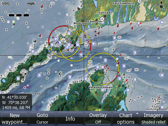
Whether you use digitized charts for fishing or navigation or, more likely, both, there are several excellent products to choose from. All offer an extensive range of functions and high-quality performance. Below are eight considered to be the Best & Brightest on the market.
The lineup is part of an exercise Marine Electronics Journal does every year as part of our Buyers’ Guide. It works like this: We ask the top manufacturers to identify the one model they produce in a particular category (17 in all) that they consider to be their Best & Brightest—not necessarily the most technically advanced or newest but rather the one they rate highest in the product line for one reason or another. Could be the functions and features it offers, or maybe it breaks new ground in maximizing effectiveness or utility, or maybe it’s the most popular as measured by sales to boaters.

TIMEZERO TZ Professional v4
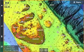
TZ Professional v4 marine navigation software offers cutting-edge bathymetric mapping capacity, allowing fishermen to make and record their own seabed maps as they cover fishing grounds and see them live or review later in 2D and 3D views. Furuno DFF-3D multibeam sonar compatibility makes it possible to overlay high-quality seabed mapping on charts, either as a dedicated view or in an overlay on the plotter. The data is amazingly accurate and allows fishermen to target grounds and identify schools of fish like never before. TZ Professional’s many features include Fishing Workspace, AIS (Automatic Identification System) and ARPA (Automatic Radar Plotting Aid) target tracking capability, Voyage Recorder module as well as C-MAP, Navionics and S-57 compatibility. All TZ Professional features can be configured to users’ needs or application.
C-Map Reveal
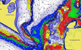
The high-detail C-MAP REVEAL charts for Lowrance, Simrad and B&G chartplotters include new features like Custom Depth Shading, Shaded Relief for inland waters, subscription-free Easy Routing and more. These C-MAP charts have all the core features needed to make the most of time spent on the water and include coverage for the US and Canada on one card. REVEAL charts offer full-featured vector charts, high-resolution bathymetry, including integrated Genesis social map data and 1-foot contour coverage for 15,000+ US lakes and 9,400+ lakes in Canada. C-MAP REVEAL charts also include premium chart features including seafloor, inland and coastal Shaded Relief. Shaded Relief delivers 3D views of land and underwater elevation, including areas of high-resolution bathymetric imagery.
Garmin BlueChart g3 Vision
Experience widespread coverage and brilliant detail when you’re on the water. BlueChart g3 Vision coastal charts provide exceptional coverage, clarity and detail with integrated data from Navionics. It also includes Auto Guidance technology, which uses your desired depth and overhead clearance to calculate routes and shows a suggested path to follow, overlaid onto your chart. The extended high-resolution relief shading feature—with 100% coverage of the continental US coastline—combines color and shadow to give you an easy-to-interpret, clearer view of bottom structure, making it easy to find artificial reefs, underwater shelves and more. NOAA (National Oceanic and Atmospheric Administration) raster cartography is also available free via ActiveCaptain app. It gives your chartplotter paper chart-like views of NOAA-surveyed areas in which points of interest are labeled with corresponding longitude and latitude information.
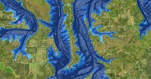
Humminbird CoastMaster Premium-Florida
Find the path to your next big catch with the high accuracy and detail of the Humminbird CoastMaster Premium–Florida digital fishing chart. With coverage for all Florida coastal waters on a single SD card, the easy-to-read contours, points of interest and predictive tides and currents data give you tools to identify fish-holding spots. Additionally, CoastMaster Premium delivers nearshore and offshore fishing performance with advanced features like 2D shaded relief, enhanced aerial imagery, and a bottom hardness layer for even more detail. Gain a deeper understanding of the waters you fish with CoastMaster Premium-Florida. Compatible with Humminbird APEX, SOLIX, and HELIX G3, G3N and G4N models.

Maptech Chart Navigator Pro
Chart Navigator Pro by Maptech is a full-featured GPS planning and chartplotting software available on a single, easy-to-load USB flash drive. It provides detailed US cartography with raster charts, photo charts, topographic maps and 3D contour charts, as well as a full array of software tools to help you plan and enjoy your time on the water. Chart Navigator Pro users benefit from AIS compatibility, chart warping, 3D bathymetric contour charts with 3D navigation aids, and the ability to import and export routes, marks and tracks to an onboard chartplotter.
Navionics Platinum+
Navionics Platinum+ charts just got better, with new high-resolution relief shading for US coastal waters now available via download. Relief shading combines color and shadow to present an easy-to-interpret, clearer view of bottom structure than contour lines alone. Designed with demanding boaters and serious anglers in mind, Platinum+ charts are preloaded with the satellite overlay and SonarChart Shading layer, 3D View, and panoramic photos to provide the ultimate situational awareness, while also offering high-quality mapping content from combined Garmin and Navionics data, advanced features and daily updates for one year. Choose Platinum+ charts for your compatible GPS plotter to quickly target the best spots and catch more fish. An active subscription is required to download Relief Shading from Navionics.com.
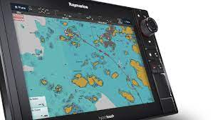
Raymarine LightHouse
The next generation of electronic charts has arrived. Raymarine LightHouse Charts offer a top-quality visual presentation, combined with rich detail and accurate navigation from official hydrographic sources across the globe. Choose between a variety of chart styles, matched with color pallets changeable for any time of day. For even more detail, subscribing to LightHouse Premium unlocks data-rich points of interest, high-resolution satellite aerial overlays from Mapbox, and regular chart updates. LightHouse Charts are now available for North America and Europe, with additional titles arriving regularly.
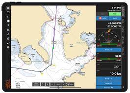
Rose Point Coastal Explorer
Rose Point Navigation Systems has introduced a full-featured version of Coastal Explorer that runs on iPads and iPhones. The user interface is virtually identical to the one on PCs, so existing users will have no problem using it right away, and new users will find the interface intuitive and clean. The free app allows you to view charts, plan routes, use Active Captain, access tide and current data and more. A subscription allows you to download charts and data for offline use. A user’s devices are all connected through their Rose Point account, so they’ll seamlessly share routes, marks, events and chart subscriptions. It works flawlessly with the Nemo Gateway.
The Marine Electronics Journal invites consumers to sign up for their weekly e-mail newsletter. We highly recommend doing this for boaters who want to stay on the cutting edge of advancements in marine electronic products and information. Click here…