New Simrad App
Simrad celebrated its 75th anniversary by launching a new app that includes a premium offering with new mapping features, advanced functionality and mirroring plus control of the company’s multifunction displays from a smartphone or table. It’s available on the Apple Store or Google Play for Android.
The free app includes up-to-date nautical charts from C-Map, personal waypoints, routes and tracks, latest marine weather, personalization and more. It lets an owner register Simrad devices to ensures that the latest updates are available. The premium version has additional functions including stand-alone navigation.
“The new mirroring feature allows you to review and direct your Simrad electronics from anywhere on the boat right from the palm of your hand,” said James Methven, global head of brand, Simrad Yachting. “This easy integration with companion devices along with intuitive C-Map charts and features make the Simrad app a no-brainer for any Simrad user to download and use.”
Upgraded Functions
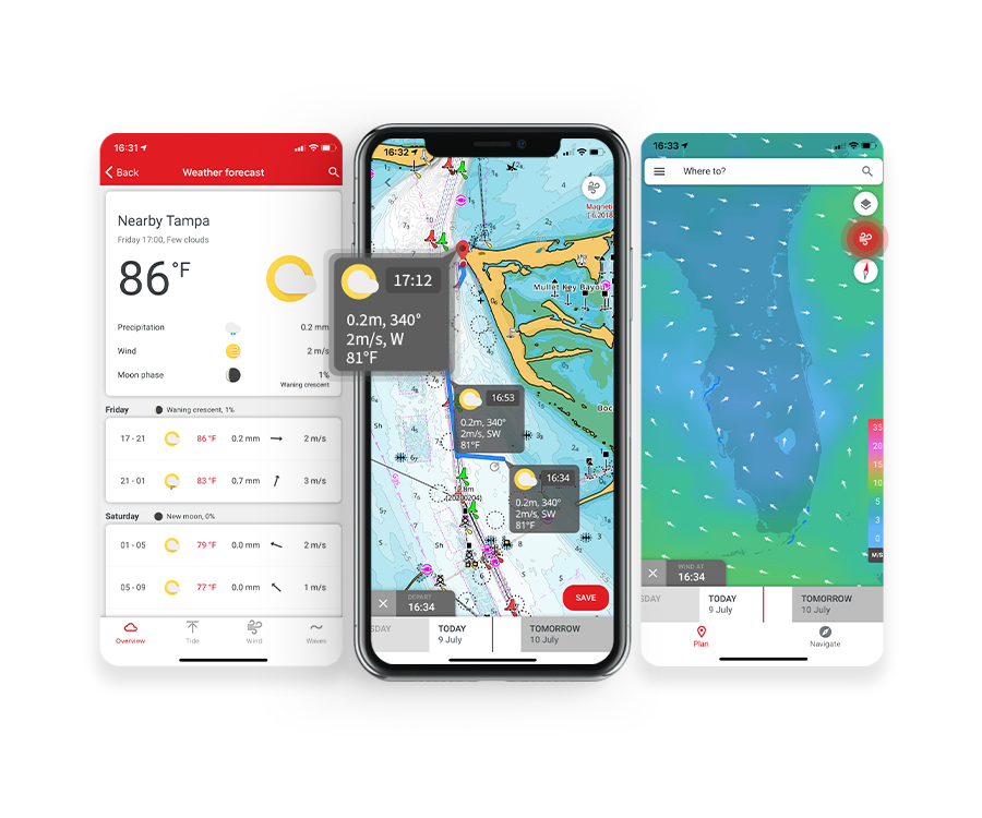
The premium version of the app offers global charts and offline maps, high-resolution bathymetry charts, AIS, Simrad Community Traffic, five-day weather overlay along route, GPS navigation data and line, track recording plus custom depth shading. The full complement of weather data is provided in both versions including wind data, sea state, tides and currents, water temperature and much more. The app also provides detailed fishing information for anglers.
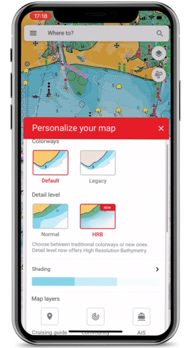
The C-Map charts on the app are designed to highlight what is most important at any time during a day on the water, maintaining accuracy and a clean, uncluttered view. The charts are powered by data from official hydrographic offices and are continuously updated and augmented from thousands of data sources.
Free Features
- Up-to-date nautical charts
- Personal waypoints, routes and tracks
- Manual and Autorouting
- Measure distance tool
- Thousands of Points of Interest
- Marine weather forecast
- Weather along the route for 24 hours
- GPX import and export
- Chart personalization: boat size, favorite units of measurement, favorite map type of view mode
- Device registration
- Device support: manuals, guides, videos
- New: Mirroring and Control
- New: Offline sync of WRnT
Premium Features: Everything in Free Plus
- Offline maps (glogal chart)
- AIS
- 5-day weather along the route
- Navigation: GPS data, navigation line, track record
- Traffic: keep an eye on other app users nearby
- New: 5-day weather overlay
- New: High-resolution bathymetry
- New: Custom depth shading
- New: Shaded Relief