Side Trip to Nantucket Island
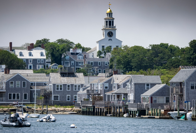
Nantucket, one of the most beautiful islands on the east coast, is 14 miles long, 3.5 miles wide and 27 miles out to sea. It is by far one of the most popular vacation spots for cruisers. When you first step ashore, you will be overwhelmed by the feeling you are stepping back in history when whaling ships filled the port and sea captains walked the gas-lit cobblestone streets.
The entire island of Nantucket is a historic district designated as a National Historic Landmark. Don't miss an opportunity to visit and spend time on this island out of time; your experience will be memorable.
Navigation Notes:
A passage to Nantucket crosses some 30 miles of open water and may call for navigation in fog. The journey to Nantucket from the west is between shoals: south of Horseshoe Shoal; north of Hawes, Norton and Cross Rip shoals; and then east of Tuckernuck Shoal. The closer to the shoals your course, the more noticeable the tidal rips.
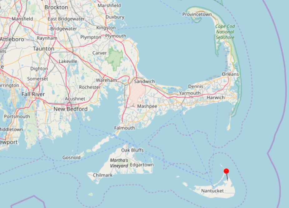
Aids to navigation are widely spaced. Frequent dead reckoning and GPS fixes should be considered mandatory as is a keen lookout (with radar if possible) for other recreational boats, fishing vessels and ferries that frequent these much-traveled waters. If the sky is clear and the water sparkling, the island stands out in spectacular fashion, even though its highest point is only 108 feet above sea level.
The red-and-white Morse (A) bell buoy "NB" marks the entrance to the buoyed 1.5-mile channel leading to Brant Point. Semi-submerged breakwaters to either side reveal the danger of straying beyond the channel's confines. A navigational range (two towers: the first a quick-flashing light and the second a constant light) will come into view directly down the center of the channel just west of the Brant Point Lighthouse.
Follow the channel buoys while turning slightly to port in order to round the 26-foot occulting red 4-second Brant Point Lighthouse. Keep a watchful eye for ferryboats and other vessels that must also negotiate this relatively narrow passage.
Once beyond Brant Point, Nantucket Boat Basin becomes immediately evident ahead, and just to the south of the boat basin enclosure, the town pier usually has a raft of fishing vessels tied to its T-shaped end. To the east of the wide inner-harbor channel upon entry, a large mooring field also should be visible.