Tips for Crossing the Gulf Stream
Mother Nature is a tough teacher: She usually gives the test before the lesson. If she used a textbook, the page for boaters would include a line that says, “Never cross the Gulf Stream in anything but a south wind.” Here are my tips for crossing the Gulf Stream.
Riding the last of the ebb tide on the St. Johns River in Jacksonville, Florida, my brother Dan and I passed Mayport and cleared the channel at sunset to begin the first offshore portion of a voyage to Nassau, The Bahamas, where we would meet up with our family for the holidays. My brother was new to ocean sailing, so I hoped for a gentle first night, but the wind blew in our faces and made for a slow and uncomfortable trip south along the coast.
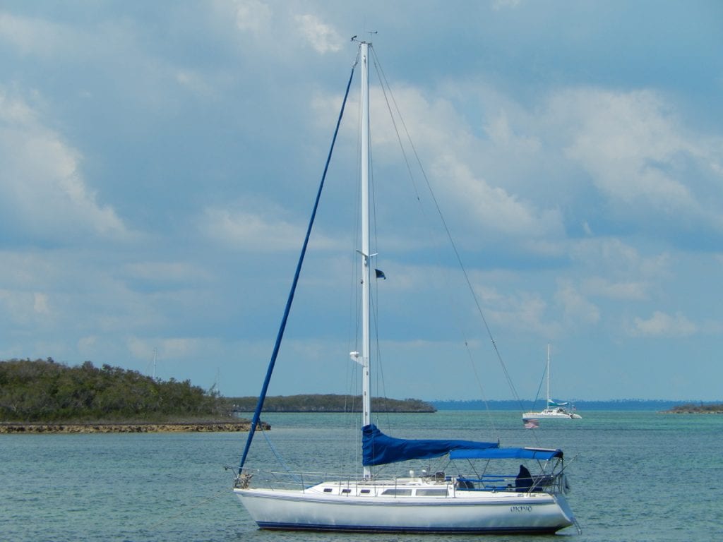
We traveled in UKIYO, my Catalina 34, in and out of the Intracoastal Waterway and as we approached Vero Beach, the wind clocked around to the west, so we pressed on into the night. When we reached St. Lucie Inlet, the winds strengthened from the north, and we had a quick ride down to Hillsboro Inlet where we topped off the diesel for a final run on large northerly swells to Miami.
Ready to Go
Dan quickly adapted to life aboard and asked, “Why don’t we cross over to The Bahamas now?” I liked his adventurous spirit, but I demurred and repeated Mother Nature’s lesson.
We grabbed a slip in Miami and made it a point to call our wives and kids to check in, hear about their fun adventures in Nassau and made sure to give them our float plan, an essential part of cruising. For an inspection check, went through the equipment, fluid levels, batteries, electrical connections, replaced the fuel filter, and checked the weather. We planned for a 0230 departure.
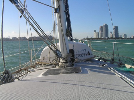
Winds were forecasted to clock around to the east after midnight and stay that way for three days—not the best news, but it was better than north, right? We donned our life preservers, rechecked the equipment, pulled anchor, and headed out Government Cut on an ebb tide with a light east wind. At the Cut’s entrance to the Atlantic, we met barn-sized breaking swells. This, of course, made travel slow and uncomfortable.
We started to second-guess our departure, especially when a dredger, which occupied half the channel and was struggling to hold station, spotted us and blew the danger signal (five short blasts of his horn) because we must have appeared to be an out-of-control vessel. We curtly exchanged greetings on the radio and carefully passed him to starboard.
I sensed Dan was a bit apprehensive, so I tried to put a good face on our situation.
No Improvements
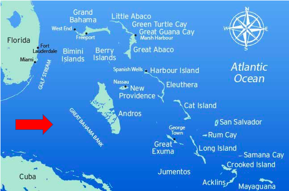
“It’s always bad in inlets,” I shouted over the sound of the engine at full throttle. “Once we get out, it’ll be better.” Unfortunately, that wasn’t the case, but I set the autopilot to 132 degrees magnetic to account for the northward set of the Gulf Stream and assured my crewmate that we only had 44 miles to Gun Cay, our crossing destination, and the warm waters of the Great Bahama Bank.
I cannot overstress the importance of reliable navigation equipment. The horizon was pitch black and without a magnetic compass and GPS, it was easy to feel disoriented and veer off course. The glow of an inbound ship appeared ahead, and I hailed it to confirm they could see us on the radar. They did, and I silently commended myself for recently installing a radar reflector, and the same for the fuel filter; as a wave pitched and rolled us, my thoughts went to the gunk that was surely getting stirred up in the fuel tank.
Shortly after sunrise, the depth sounder went blank, and the water became the deepest blue I had ever seen. Flying fish skittered ahead as huge waves gently lifted us to foamy crests glistening in the morning light, then gently set us down again in the troughs. Even on a lonely sea, there’s always a risk of collision. It’s important to do a 360-degree sweep of the horizon frequently. Out of nowhere, the giant Bimini SuperFast Ferry crossed our path and came close enough for us to see the passengers’ amused faces on the poop deck.
Tips for Crossing the Gulf Stream
The Gulf Stream current ranges from one to 12 miles off the South Florida coast and is approximately 45 miles wide. Its speed is generally between two and four knots. Wind affects surface waters and when it is in the opposite direction of the current, can produce rough seas—wave heights increase and can break, which causes more stress on the hull (and slows you down). The advice to cross in a south wind rings true. As it was, an east wind crossing the current sideways didn’t help much either. Another hazard is due to the Gulf Stream’s warm waters, which can create its own weather, particularly thunderstorms with lightning, heavy rain and strong winds. The current affects every boat, whether power or sail.
After noon, the wind backed just enough for us to raise the reefed mainsail and make for a much more stable ride and, finally, some hot coffee and grub. However, the updated forecast for continued east winds did nothing to buck up our spirits. We posted hourly GPS positions to the chart and it was obvious that despite the offset to our heading, our track was farther north than expected. We crossed the Gulf Stream by sunset but were several miles northwest of Gun Cay; time to correct to a southeast heading.
Happy Ending
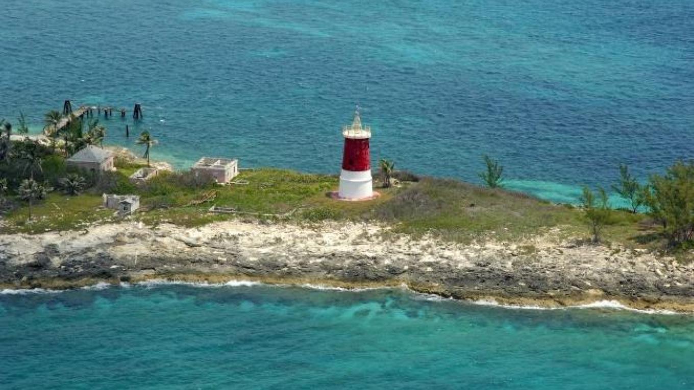
A long night passed, but the lights of Bimini to the southeast kept us focused. It wasn’t until predawn when we could see the silhouette of Gun Cay lighthouse. Another valuable lesson: The navigation lights in The Bahamas don’t always work.
Gingerly, we transited the pass, hoisted the Q flag (signaling we had not checked in) and carried on. After 47 adventurous (and educational) hours from Jacksonville, we anchored on the Great Bahama Bank at 0145 for a meal and a few hours respite; happy in the knowledge that we successfully made the crossing and were within a day’s sail to Nassau and a family Christmas.