Understanding Echo Sounders
By Dag Pike
Echo sounders were one of the original electronic systems, developed some 60 years ago. I remember those early units with a grey box sitting on the dash with the indicator whirring round and round. It was a much better solution than using the lead line and it gave you a constant read out of the depth, which was a great advance in navigation at the time. Today, with the advent of GPS positioning and sophisticated electronic charts the sounder is used less and less but it still remains a great navigation tool and it can provide a vital check on the other electronic systems.
Measuring Depth
It is important to remember that the sounder only measures the depth directly under the hull so it will not give you any warning about dangers ahead. With this in mind, you are more likely to be interested in the trend of the measured depths, rather than the actual depth itself. Is the depth getting deeper or shallower can be important and this is why we are seeing sounders getting much more sophisticated? Modern graphic displays showing the soundings over the previous few minutes or more so you can get a much better picture of the trend of the depths.
The depth measured by the sounder can be displayed in a number of ways. The simplest is a digital display that shows the current depth measured in either meters or feet, or perhaps on some older displays, even in fathoms. This can be valuable if you are making a landfall in reduced visibility, or if you are crossing a shoal or trench on the seabed and want to see where it begins and ends so that you have a sort of depth position line to confirm your position. This type of graphic display can often be shown on a split screen alongside the electronic chart and more sophisticated depth sounders also use this type of display when searching for fish. When you are using the sounder for navigation, remember that what you see displayed on the screen is essentially history as soon as you see it because it shows the depth directly under the boat and you will already have moved on by the time you read it.
Clues to Your Position
When you look at the chart, your position must lie somewhere along the depth contour relating to the depth shown by the sounder, thereby enabling you to create a position line of sorts. A sudden steep change in depth will give a more precise position line than one where the depth is changing gradually but again this must be related to what you can see on the chart. The measurements from the sounder can, therefore, act as a useful check on the GPS plotting because the depth from the sounder should relate directly to the chart depth for the position shown, although you must of course bear in mind any tidal depth variations.
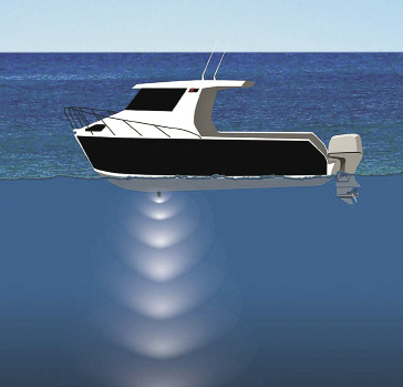
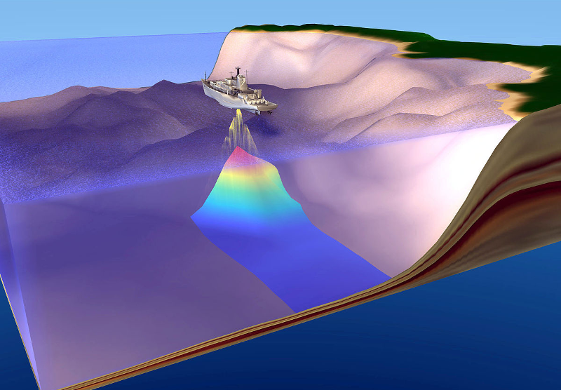
Depth is measured from a transducer, which is normally mounted in the hull. This sends out the sound signal, which is then reflected back from the seabed. The depth is calculated by measuring the time that elapses between sending and receiving the signal. This is then halved and for accurate readings, you need to know exactly where the depth reading is being measured from. If the transducer is located in the lowest part of the boat, which could be best if you are operating in shallow water, you will need to add the depth of the transducer from the surface plus any tidal variation in the depth to find the actual depth for a chart comparison.
On a Sailboat
The transducer will normally be hull-mounted, so you may have a few feet to take off to find the depth under the keel. It is also important to know whether the reading has been adjusted to show the depth from the water surface or from the depth under the keel. Most sounders allow you to make this adjustment but you can check which setting has been used on your sounder when you are in harbor by measuring the actual depth from the surface using a weight on a rope and then relating this to the depth shown by the sounder. If the two correspond, the sounder is obviously set to measure the actual depth of water.
It can also help to know what sort of transducer you have fitted. Some may produce a narrow-concentrated sound beam, which is the type that will normally be used when the sounder is capable to measuring in quite deep water or for fish finders. More generally, the transducer will provide a wider sound beam what will measure depths from a wider circle of seabed, taking the least depth as the one that is displayed.
With the advent of chart plotters, there is less emphasis on the use of depth sounders, but to my mind they still have a vital role to play in navigation. They are the ‘eyes’ underwater and provide a real time reading on the distance between you and the seabed. Without the sounder, you have to rely on the depth information shown on the chart. This can be out of date and change with time. When there are differences between the sounder reading and your charted position, it can also provide an important warning that all is not well with the navigation.
In terms of value for money, sounders offer very useful information and they should be on all the time when making landfalls or coming into an anchorage where the navigation marks may be few and far between. Most of your navigation dangers are hidden underwater so the sounder becomes the ‘underwater eyes’ of your boat.