Waves
By Dag Pike
The Unknown
It always surprises me how little many boaters know about the environment in which they operate. To many, the sea is just a pattern of regular waves that cause the boat to do a bit of rock and roll. You don’t go to sea if the wind is blowing at over 20 knots or so. Both the wind and the waves in any place at sea are a mixture of high and low, weak and strong and nothing is really settled. It pays to spend some time studying the sea and getting to understand it if you are going to get the best out of the wide ocean, your playground, with your boat.
Finding the Pattern
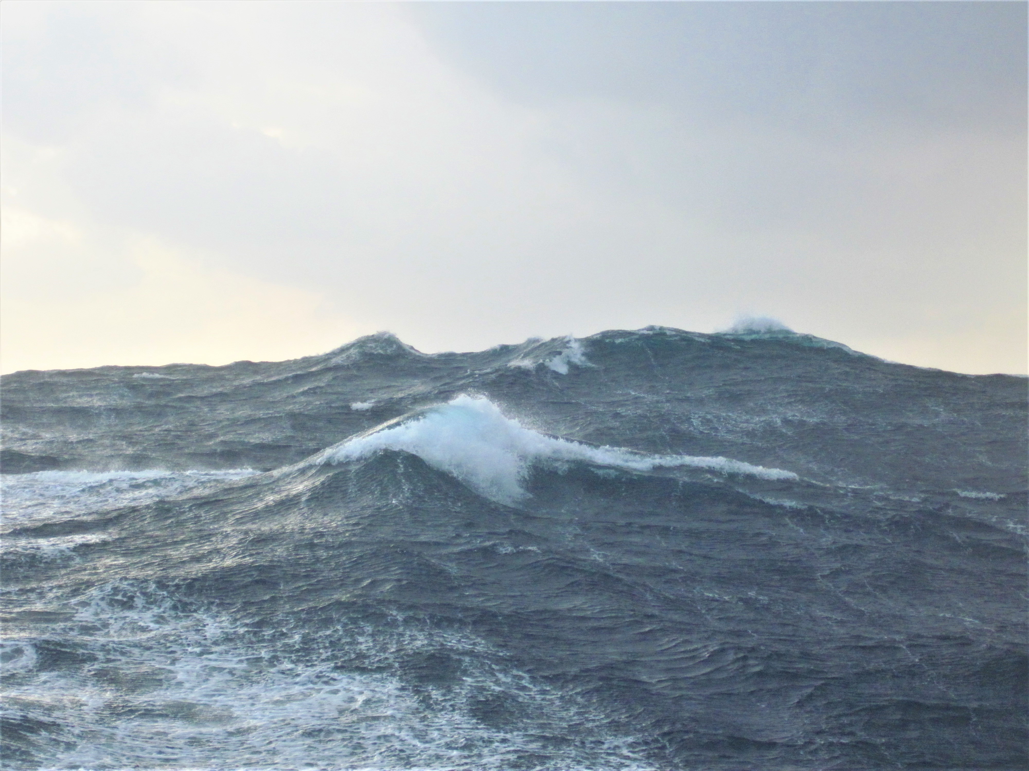
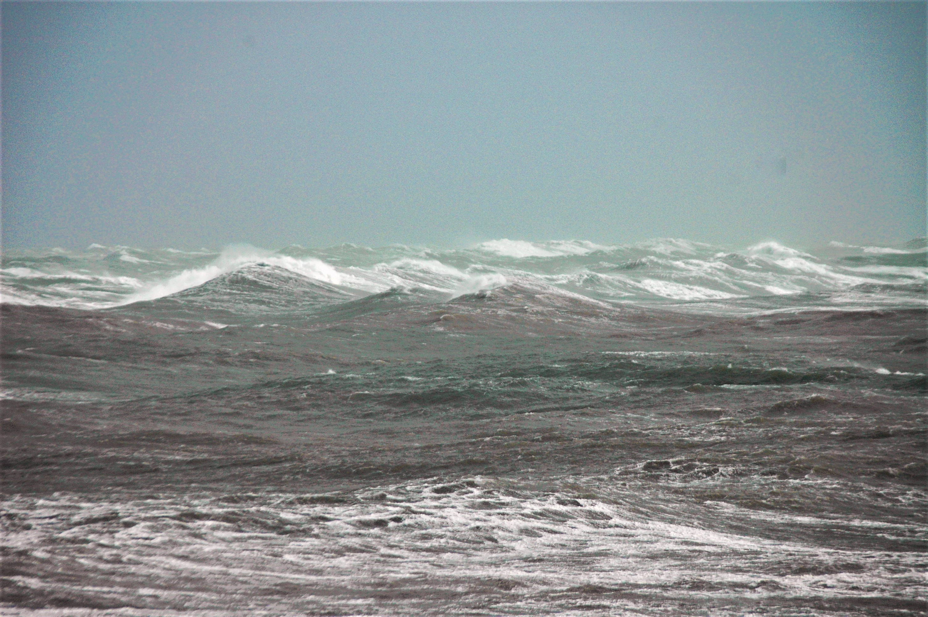
When you study waves, you begin to realize just how irregular they can be and this is born out by the forecasts. Looking at a recent National Weather Service marine forecast, it gave the waves as 4 to 6 feet high with occasional waves of 8 feet. This shows that even is what might be termed ‘normal’ conditions you can find waves double the regular height amongst the regular waves. That can be a significant difference when you are trying to find a cruising speed where the boat is comfortable for the conditions. Forecasts tend to talk about significant wave heights and this is the average height of the third-highest waves so you could find some considerably higher in amongst those significant waves
I have spent hours just watching the waves and it is not only the variation in wave height you become aware of but also the wave direction. You can find crossing wave trains where waves come along from two different directions. Where two waves meet in these crossing wave trains you can find short term pyramid waves that can give you a nasty shock if you happen to be in that location.
Navigation
This takes you right back to the early navigators such as Columbus who was faced with the problem of making a landfall on coasts where he had no charts. If you learn to ‘read’ the waves you can get a feel for where there might be shallow water and where it might be safe to go.
We did this ‘wave reading’ when we were crossing the Atlantic on one of our record attempts. Many people cruising the East Coast will opt to take the Cape Cod Canal rather than take the outside route when heading north from New York because off the coast here are the notorious Nantucket Shoals. I worked out that if we crossed the shoals directly, we could shave about two hours on our voyage time but the chart suggested that the area had not been surveyed for a long time and the shoals were constantly changing.
The Rocky Risk
My solution was that because there would be a swell running over the shoals from the Atlantic, any shallow patches would show up as breaking waves, which we could steer around to avoid them. It was a high-risk strategy because we were a very high profile event and a grounding would be more than embarrassing but it was justified by the time-saving. In the event, we only saw one patch of breaking seas and were able to safely steer around it and when you think that we only broke the record by a matter of two hours the risk was fully justified.
That might not be a risk that you are prepared to take in normal cruising and that Cape Cod Canal could be a very attractive alternative but breaking waves can be both a warning and a navigation tool. I have noted that where there are strong currents or tides running there can be patches of nasty seas and breaking waves off the headland. However, off some headlands, there can be a patch of calmer water inshore where the current is weak and the waves don’t break but before attempting this do make sure that there is an adequate depth of water to pass close inshore. In making such a passage you will be guided largely by where you can see the breaking waves rather than what the GPS says. Again you want to prepare carefully before making such a passage and get local knowledge if you can.
The Beaufort Wind Force Chart
Bear in mind that when the wind is against the current the waves become shorter and steeper making them harder to find a comfortable way through. Under these conditions where the waves get steeper, you can find then with white crests as they start to break. When the wind is with the current then expect a much more comfortable passage because the wave crests are further apart.
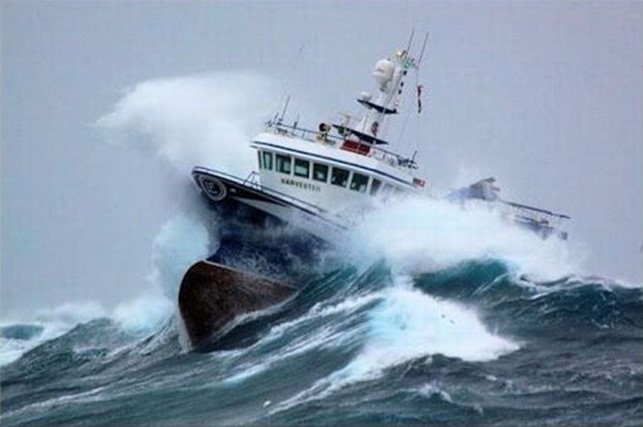
We saw this when we were doing a powerboat race around Britain. It is a challenging event and on this leg of the race there was a strong wind from the northwest so we made a detour with the wind on the bow rather than dead ahead so we could make a faster speed. This eventually took us in under the lee of the land when we could get up to full speed but that meant negotiating a narrow passage between the mainland and an island. I knew the passage well and was confident about the navigation but when we got there it was just wall to wall white water right across the channel caused by the strong current that run through the channel combined with the rocks in the channel.
Not So Draft
We had not planned this route, but I was comfortable with the water depths as long as we made a course to avoid the two rocks that sat on either side of the channel. As the driver did not know my route he just opened the throttles wide and we went through like a cork out of a bottle before slowing a bit to cope with the waves on the other side. It was only when we got into harbor that I asked why he had increased speed. “I thought that it was very shallow water so if we went fast it would reduce the draft!” For him, it looked like I was navigating right on the limit but we won that leg of the race by 40 minutes so our deviation was well justified.
Breaking waves can tell you a lot about what is going on under the water as the navigators of old knew very well. Today we are spoilt by very accurate positions at our fingertips but knowing and understanding the waves, how they can change with changes in the wind and the currents or even change with the tide. There is a lot to learn but all of these factors are important if you want to be a competent navigator. The sea should be your friend not you enemy so get to know it well.