Your Bahamas Adventure Starts Here: The Gold Standard in Marine Charts

For 30 years, Explorer Chartbooks has been committed to providing the most accurate and detailed charts of The Bahamas. This dedication to quality is why they've become the go-to resource for cruisers.
The team at Lewis Offshore, Ltd. ensures their charts are always up-to-date. They use a combination of their own on-the-water surveys and valuable contributions from other vessels to provide the most comprehensive and reliable cruising information available.

Aqua Map, Explorer Chartbooks, and Waterway Guide have teamed up to bring you a seamless navigation experience. Now, you can find the same trusted charts and cartography in all three places—your Explorer Chartbook, the Waterway Guide Bahamas edition, and the Aqua Map mobile app. This makes it easier than ever to plan your route and cross-reference information as you navigate the Bahamas.

When you're planning your Bahamas expedition, you'll love how consistent all the Explorer Chartbooks products are. No matter if you're using their books, charts, or mobile navigation app, the depths, contours, locations, and symbols are all the same. This seamless experience makes planning and navigating a breeze.
For on-the-go navigation, the spiral-bound Explorer Chartbooks are an industry standard. These water-resistant, 12" x 18" books have been updated with the latest information, including tips on provisioning and destinations. The team at Lewis Offshore, Ltd., has been exploring the Bahamas since 1974 and has been charting them since 1991. They've created a leading three-volume set of chartbooks that covers the Near Bahamas, Exumas and Ragged Islands, and the Far Bahamas with Turks and Caicos.
If you prefer digital tools, the electronic data from Explorer Chartbooks is also available through many chart plotter and mobile app providers.
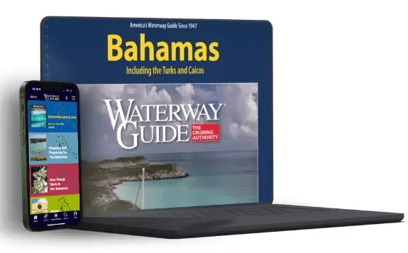
Waterway Guide's Bahamas Edition contains over 90 chart extracts from Explorer Chartbooks that provide situational awareness and citations for where to locate the complete charts by edition and page numbers.
Aqua Map's mobile app now features the well-known Explorer Chartbooks, using the same familiar color scheme as the printed versions. You can access the complete collection of Bahamas charts through the app's library.
These charts, identical to those found in the printed Explorer Chartbooks and Waterway Guide's books, are available in both raster and vector formats. They are fully scalable and searchable, with additional data overlays for better navigation and planning. This extra information includes marinas, anchorages, bridges, and fuel locations from the Waterway Guide.
To ensure accuracy, the information for the Waterway Guide Bahamas, Explorer Chartbooks, and Aqua Map is updated on different schedules: real-time, daily, and every two years, depending on the format. The three publishers have combined their expertise to provide the most reliable data available for your trip to The Bahamas. Look for special bundle pricing when you make a purchase.